Day 041a: Blame It on the Tetons

Pic: Five boobs. Jackson Lake, Grand Teton NP, WY

I awoke to sunrise and “Bark! Bark! Barkhoooooooooooowl!” A pause. Then: “Bark! Bark! Barkhoooooooooooowl!”

“Control your dog, sir,” I thought, but as the ruckus persisted I decided it sounded a little howl-y for a dog. I walked around the corner to investigate, also scouting the muddy stretch that threatened to keep Isa and me from returning to the main road. A lone coyote sat in the meadow 150 yards away, bark bark barkholwing into the wide-open valley and getting no response. It was clearly aware of me as I came into view, ears perked and gaze locked on the weird bipedal interloper. Eventually it stopped howling and wandered off.

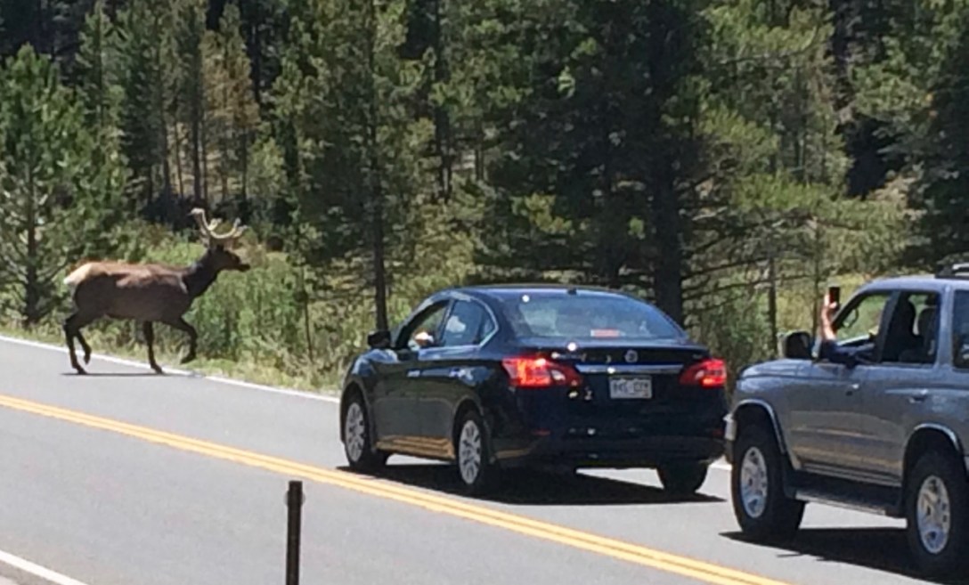
Driving back toward Jackson through the National Elk Refuge, I met up with a pronghorn jogging next to the road. I slowed down. “Are you going to be smart and stay on your side?” I asked. Nope! It zagged directly in front of me, crossed the road, and continued running in the same direction at the same speed on the other side. Prey animals!

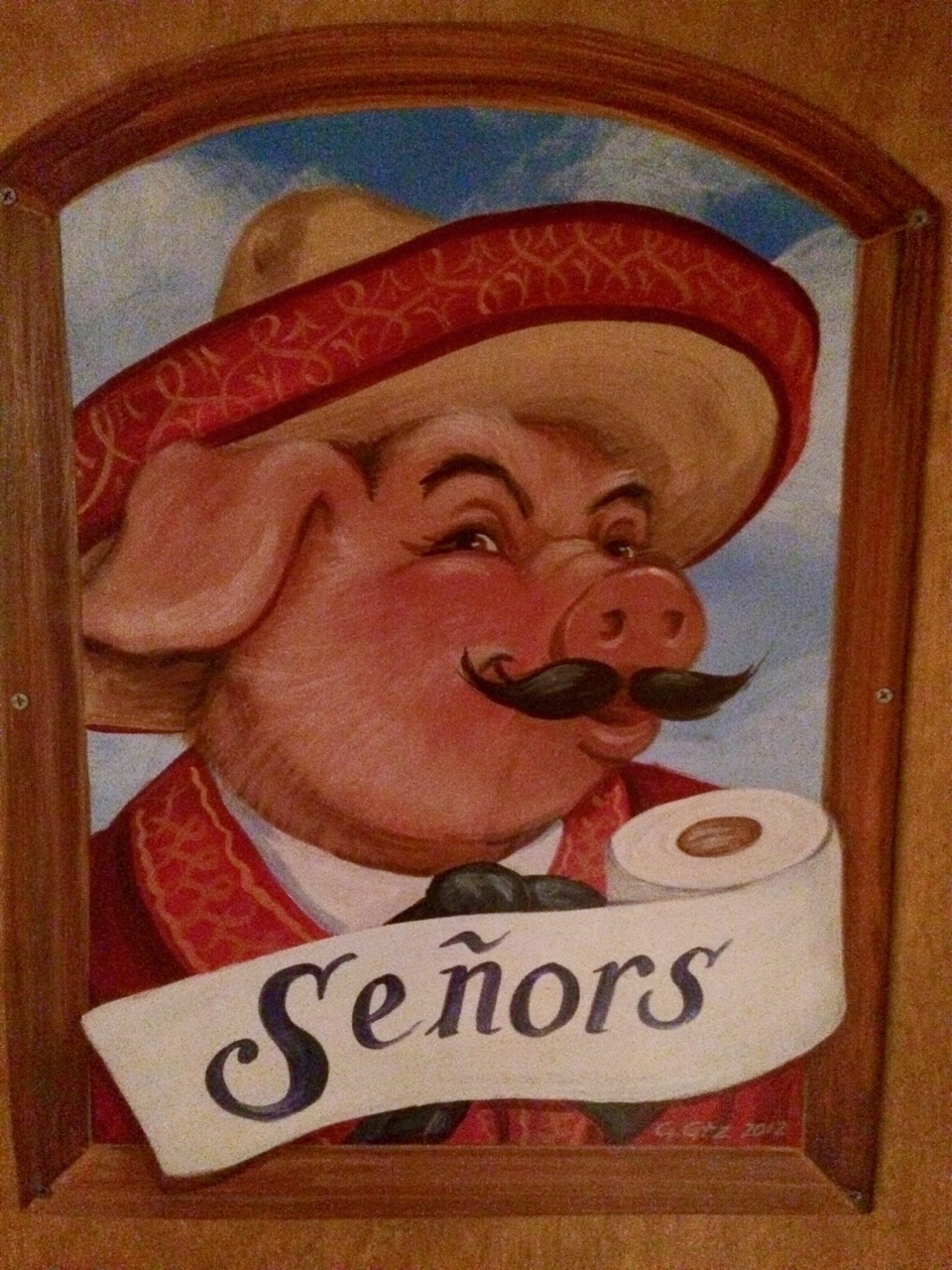
After a quick brunch to satisfy my latent addiction to eggs benedict, I stopped at JD High Country Outfitters to pick up some gear I would need for backpacking in grizzly country. I chatted with the saleswoman about bear cans and bear spray and learned that for twenty years she had run the affordable housing program in the town where I was born and raised. We talked about being a socialist in red country. She said being a liberal gun nut helped and told me how much she liked her AR-15.

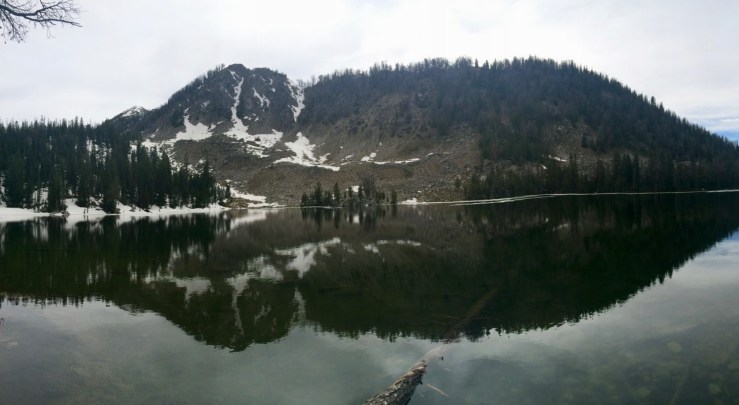
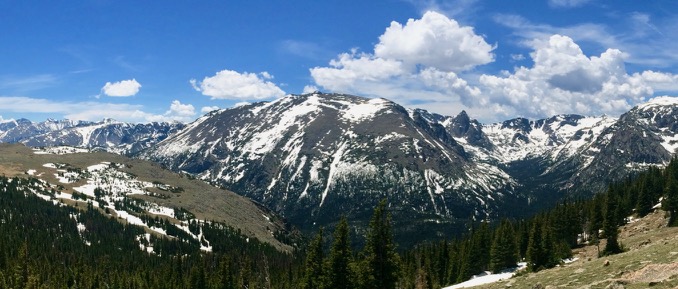
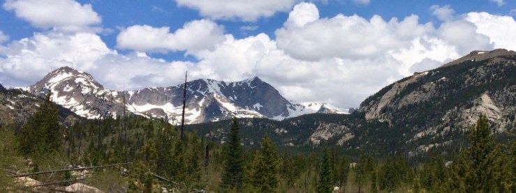
I spent the afternoon driving through the park with short stops to explore String Lake, Jenny Lake, and Jackson Lake Dam. The Tetons formed a picturesque backdrop for everything in the valley, rising up seemingly out of nothing.

Day-041a-Tetons-Teewinot-Grand-Teton-Owen

Pic: Everyone’s a building burning. Teewinot Mountain, Grand Teton, and Mt. Owen. Jenny Lake Rd, Grand Teton NP, WY

Day 040: Take That, Linnaean Taxonomy!

Pic: Slime mold with fruiting bodies; neither plant nor fungus, slime molds are weird Communist collectives of single-celled organisms. Goodwin Lake Trail, Bridger-Teton NF, WY

Things that are unnerving:

  • Waking up in the middle of the night to lightning, thunder, rain, and wind. How long has it been raining? How saturated is the ground? How far away from those three huge pine trees did I set up the tent??
  • Waking up in the middle of the night to every coyote in the valley howling at each other simultaneously. How many coyotes could I fight off while wrapped in a sleeping bag??

With the help of some mobile signal and MyRadar, I found a relatively dry-looking window in the day’s thundershowers. I took my pizza-bagel-under-a-tree break a little early when, fifteen minutes into the hike, the showers escalated to actual rain and hail for fifteen minutes. After that first half-hour, I had calm weather for the rest of the climb to Goodwin Lake.

Day-040-Goodwin-Lake

Pic: It was good, hikin’ to you, a-ha. Goodwin Lake, Bridger-Teton NF, WY

Things that hurry you back down the hill to the parking lot:

  • When you see lightning and only count four Mississippis before you hear thunder.

Day 039: Eso No Se Escribe Así

Pic: Ten times more charming than that Arnold on Green Acres. Bathroom door, Merry Piglets Mexican Grill, Jackson, WY

Rock Springs presented me one final gift during my last errand of the day (buying additional hiking socks):

Day-039-Water-Sports-10-Percent-Off

Pic: Presented without comment. Sports Authority, Rock Springs, WY

Part of the main quest for this road trip was the “Where do I live next?” game. Whenever I would eat lunch or buy groceries in a town, I’d daydream about what it might be like to
live there. Pinedale, WY, on the way to Jackson, was the first town to get serious consideration due to its motto: All The Civilization You Need. Hoback Valley had a little of that “this could be my playground” feel, but I decided seventy minutes (in good weather) to Jackson Hole was too far.

Day 038: That’s a Funny Way to Spell “White People”

Pic: To be fair, the motto comes from “the influx of immigrants from all over the world who came to work in the coal mines that supplied the fuel to power the steam engines of the Union Pacific Railroad.”[1] Rock Springs, WY

The drive up CO-125 was prettier than expected, paralleling the Colorado River until the mountains fell away and left prairie: large, flat, grass-filled nothing. It was an interesting feel, but it only validated my decision to venture no further east of the Divide than Denver.

I was comfortable in my understanding of how the Continental Divide works until I somehow crossed it three times. The first seemed legit, heading north through an obvious mountain pass. Then, while driving due west on I-80, I crossed it twice more. Huh?[2]

One of my failings as a human is my weakness for fast food. It was with probably too much delight that I noticed both a TacoTime and a Sonic within walking distance of my room at the Super 8.

My go-to TacoTime order is two Crispy Burritos — the chain’s signature deep-fried tortilla tubes — one filled with ground beef and the other with refried beans. I am careful to enunciate my order since “meat” and “bean” sound alike, especially when shouted from the cash register back to the fry cook (TacoTime Crispy Burritos are fried up on the spot![3]) Different stores have different methods for disambiguation. A common one is to call the bean burrito “pinto”. The TacoTime I went to as a kid called Crispy Meats “#1” and Crispy Beans “#2”. But my years of TacoTiming did not prepare me for this exchange:

Me: Can I get a Crispy Meat…

Cashier: [over shoulder to fry cook] Meat!

Me: …and a Crispy Pinto Bean.

Cashier: [over shoulder to fry cook] Waldo!

Fascinated, I asked the cashier about this terminology. Is (or was) Waldo someone who worked here? She only shrugged: “That’s what we call ’em.”

For dessert I headed to Sonic, where I felt a little uncomfortable ordering a “Waffleberry Brownie Master Blast” from the unseen but surely underage girl on the other side of the intercom. It was delicious, but I would only order it again if I didn’t have to say it out loud. I should not have to wonder if my dessert has an urbandictionary entry.


[1] Rock Springs, Wyoming

[2] I only now remembered to ask Google, “why are there two continental divides in Wyoming?” Apparently the Rockies split and form the Great Divide Basin from which water does not drain. You can see the curiosity on this map of major hydrological divides[4].

[3] TacoTime, give me free stuff!

[4] Why yes, I am really fun at parties. Now, who here likes a good story about a bridge?

Day 037: I Love These Meeses to Pieces!

Pic: Shiras moose bulls. Big Meadows, Rocky Mountain NP, CO

After consulting the ranger station in Granby, I found camping in an area popular with OHVs. Between the ranger I spoke with and signage at the National Forest boundary, I came away with two heretofore unrecognized fears:

  • With the mountain pine beetle infestation there were tons of dead or dying trees that could fall over at any moment and crush me (or my car with all my possessions).
  • The ground was saturated after the spring melt, so the slightest breeze could knock over a tree at any moment and crush me (or my car with all my possessions).

Meanwhile, I was in A FOREST so unless I wanted to camp in the road or a parking lot[1], I would have to camp near some trees. I ended up pitching the tent in a bit of a clearing next to an established fire pit. The surrounding trees all looked… alive and upright?

A spur-of-the-moment alternative return route ended up including passage through a steep ravine on a sketchy, washed-out section of road, but Isa kept her footing and soon I was back in Rocky. I picked the Green Mountain-Onahu Creek loop (7.5 miles, 1300′) mostly for its low elevation and proximity to the Grand Lake entrance. I would head to Wyoming this afternoon and there were a few hours of nothing between me and the oases of fast food and cheap motels on the I-80 corridor.

The highlight of the hike came early, when I arrived at Big Meadows and found a couple of young bull moose eating brunch thirty yards from the trail. I enjoyed them for quite a while, but reminded myself to have an escape route since moose give zero fucks. Up close, you can tell from their demeanor.

My bench for lunch, an old fallen pine next to a rushing creek, turned out to be sappier than expected. I got resin on my pants, my sandwich bag, and my apple (and subsequently on my hands, my backpack, my beard…). Though I rinsed the apple in the stream, a little of that fragrant pitch remained, lending the aroma of the forests to every bite of Granny Smith. I don’t know if eating sap is good for you or not, but I’m tempted to recreate the concoction. I call it: the pine-apple.


[1] Neither of these options is legal, fun, or particularly popular with other forest visitors, by the way.

Day 036b: 1.5 Tylers of Snow

Pic: When Dave struggled to recommend hikes, this snowpack was why. Trail Ridge Road, Rocky Mountain NP, CO

Compared to the mountains I’m accustomed to, there was a lot of snow for June. During my stop at the Gore Range Overlook, I even encountered a fellow in his 20s skinning back up to his truck. I asked where he’d been skiing. He smirked and shook his head: “There’s lots of snow everywhere still.”

After a few stops in the rarified air above treeline, I followed the road as it wound its way back down to Earth. Solidly back in the forest at “only” 10,759′, Milner Pass is home to the Continental Divide, a wiggling dashed line on the map that delineates whether a given raindrop will ultimately return to the Pacific or the Atlantic.

I, like almost everyone who stopped at the Milner Pass parking lot, wanted a snapshot in front of the sign marking the Divide. I offered to take a picture for a couple if they would take mine afterwards. He posed facing east from the Atlantic side while she grabbed his waistband from behind as if dragging him back toward the Pacific.

“That was cute,” I said, handing their camera back. “And, it makes me feel better about the dumb picture idea I had.”

Day-036b-Tyler-Continental-Divide-Milner-Pass

Pic: The dumb picture idea I had. Milner Pass, Rocky Mountain NP, CO

The hugeness of the Rockies became more real to me once I got closer to them. I’m beginning to see how awesome it would be to hike on the Continental Divide, amongst and upon those giants, when they’re not entirely snowbound. Rocky and Capitol Reef are the two parks I most wish to return to and explore further.

Day 036a: Hey! I’m Walkin’ Here!

Pic: Although there’s no crosswalk, this young North American elk bull has the right of way. Trail Ridge Road, Rocky Mountain NP, CO

After a lot of walking yesterday, I was happy to take a break with one of the country’s epic scenic drives. The Trail Ridge Road is another legacy of the Park Service of the 1930s, an organization that brought public access to wondrous natural beauty through infrastructure development while remaining mindful of aesthetics.

Here my “too early” timing for Colorado proved useful, as the only-just-cleared-of-snow highway wasn’t too crowded. I survived my first three elk jams! The males were quite fetching with their new velvet-covered antlers.

The views from the frequent pullouts became more and more incredible as the road climbed and climbed past long sloping valleys toward the the roofbeam of the continental United States[1]. Topping out at 12,183′, the eleven miles of asphalt above treeline felt like driving on another planet thanks to the peculiar quality of the sunlight, the noticeably thinner air, and the sense that the whole planet lay splayed out below.

Day-036a-Stones-Peak

Stones Peak from Trail Ridge Road, Rocky Mountain NP, CO


[1] This seems like as good a place as any to remind smug Coloradans that the highest point in the lower 48 is in California: Mt. Whitney in the Eastern Sierra. : )

Day 035b: The Secret of the Ouzel

Pic: Copeland Mountain and Ouzel Lake, Rocky Mountain NP, CO

My first ten miler of the season! The official mileage was 10.2, but my various side quests pushed the total over 11.

Intel from rangers and my experience at Tanglewood Creek suggested the snow line lay at around 9500′. Sure enough, as soon as I forked off of the sunny ridge that continued up toward Bluebird Lake, the trail disappeared into a snowfield. Fortunately, there was good bootpack all the way down to the lake. Even better, the place was deserted except for a lone angler, trying his luck from a hundred yards down the shore.

Off the beaten path, the snowpack was… inconsistent which curbed my exploratory tendencies. I found a secluded spot in the trees to take my lunch and enjoy the tranquil view.

I packed up while eyeing the increasingly dark clouds over the ridge. Drizzle started as I said goodbye to the lake and picked my way over dirty bootpack back to the main trail. I had just reached the fork when I heard and then saw my first marmot!

Day-035b-Yellow-Bellied-Marmot

Pic: Who gives a shit about the yellow-bellied marmot?! Bluebird Lake Trail, Rocky Mountain NP, CO

As I headed back down the ridge, the sun came out! …and simultaneously the drizzle became full-on rain. Hi, Colorado!

Day 035a: Don’t Go Chasing Ouzel Falls

Pic: Not the rivers and the lakes that I’m used to. Ouzel Falls, Rocky Mountain NP, CO

Dave has lived almost his entire life in the forests of Colorado, so I was surprised when he struggled to recommend good hikes for me in Rocky Mountain NP. The problem, he explained while perusing maps, was that I was here too early. The Rockies don’t really get going until about 8000′, and the really cool stuff is above 12,000 feet — especially the state’s famous collection of “fourteeners” — still buried under tons of snow.

Julie poked her head in. “What about Ouzel Lake?”

“That could work,” Dave said, handing me a book from his stack of trail guides. Let’s see: a 10.2 mile, 1700′ round trip past several waterfalls to an alpine lake at the foot of 13,176′ Copeland Mountain, all at or below ten thousand feet? I’m in.

I was a little nervous about crowds as I crept through the sizable but rapidly-filling trailhead parking lot, especially when two vans full of 8-10 year old girls from a nearby camp pulled in behind me. But after the first minor waterfall a mile or so in and especially after spectacular Ouzel Falls, I saw only a few other hikers.

The base of Ouzel Falls was a gorgeous, if obvious, spot to break for lunch. Even if it hadn’t been too busy for my tastes, I would have explored and found the social trail and minor scramble leading to the top of the 40-foot drop.

Day-035a-Top-Of-Ouzel-Falls

Pic: Having it my way or nothing at all. Top of Ouzel Falls, Rocky Mountain NP, CO

My efforts also earned me a preview of Copeland Mountain and a few of its neighbors.

Day-035a-Copeland-Mt

Pic: Moving too fast. Copeland Mountain, Rocky Mountain NP, CO