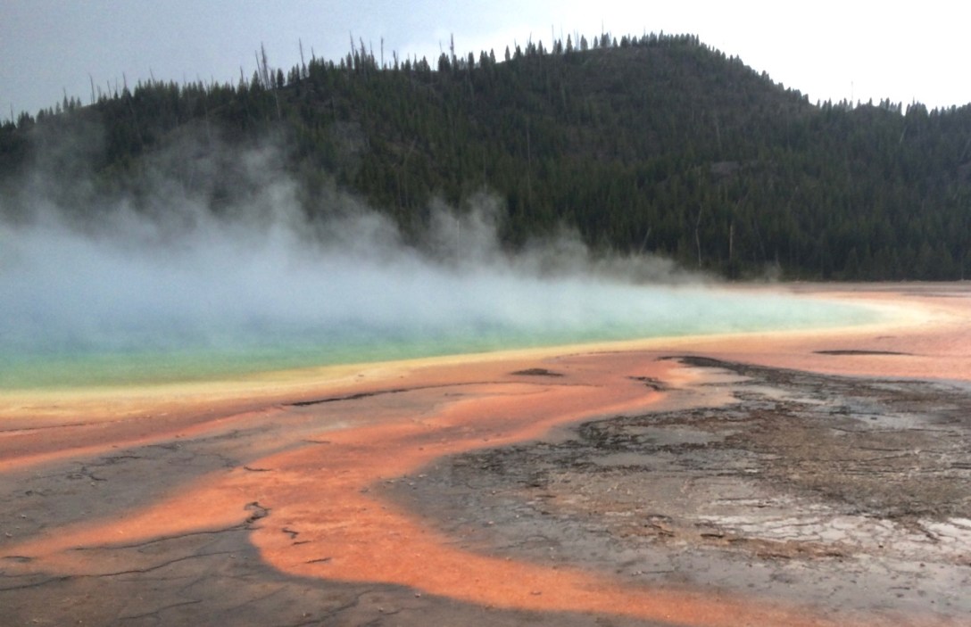
Pic: What on Earth? Vol. 2. This Smithsonian article explains the science and includes better pictures from days when it wasn’t hailing. Grand Prismatic Spring, Yellowstone NP, WY
A little sleepy from my early morning, I took a nap in a quiet area of the Canyon Village parking lot. Dirtbag achievement unlocked!
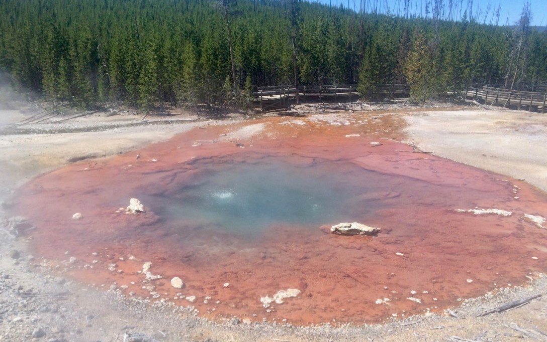
I had saved arguably the best — and decidedly the busiest — section of the park for last: the Old Faithful area. I waited for the late afternoon, hoping to swoop in quickly and avoid crowds while leaving enough time to see Fountain Paint Pots, Terrace Springs, and Grand Prismatic Spring before backpacking 3 miles and 900′ to Mallard Lake for the night.
The plan worked pretty well, except I misjudged a band of clouds and ended up visiting the mind-bending Grand Prismatic Spring in the middle of a hailstorm. The ambient humidity shrouded the warm, colorful pool in fog which looked cool but obstructed the view. I was told that the best perspective is from the top of a nearby hill but that the trail and overlook were closed for a much-needed redesign. Regardless, the striking rainbow colors made Grand Prismatic one of the coolest natural phenomena I have ever seen.
Pic: From now on, you may now refer to me as Your Excellency. Yellowstone NP, WY
Waking up while it’s still dark sucks (I’m sure the eight or so groups sleeping within 50 yards of me as I struck camp thought so as well), but it was worth it since I SAW WOLVES!
There is a group of hearty folks who hike out to a ridge in Lamar Valley every morning at dawn, set up spotting scopes, and look out across a stream bed busy with bison, pronghorn, and sandhill crane to a slope 1.3 miles away where a family of gray wolves lives. Devotees share intel using local landmarks: “Left of the Lone Tree, just before the Two Trees, above the Light Patch…” “There she is!”
I stood behind the line, trying to follow along using a cheap pair of hand-me-down binoculars (thanks Beth!), but it was hopeless. Fortunately, the spotting scope crew was extremely gracious in sharing the view: “Anyone want to see the wolves?” was almost as regular an announcement as location information on the animals.
I waited for a turn and was rewarded with an incredibly rare spectacle: wild wolf pups playing on a hillside. It was impossible not to compare these animals to modern domesticated dogs as I watched the six month-olds chase their tails and wrestle while their mother moved calmly but watchfully from a sunny spot in front of the den to the shade of a nearby lodgepole pine.
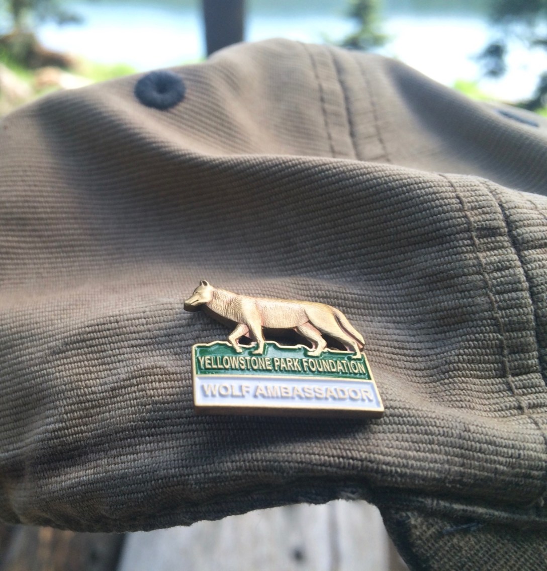
I chatted with a few of the wolf spotters as I squinted into their viewfinders. First, a retired couple living out of their RV in Gardiner. They came out most mornings to watch the wolves.
Then, I talked with a soft-spoken ranger in his 50s. I asked him about Gene the Camp Host’s claim that “wolves don’t belong in Wyoming.” He talked about the wolf’s PR problems (Gene had called them “killing machines”), their role in keeping elk and sheep herds healthy by culling weak animals, compensationprograms available for ranchers, and Decade of the Wolf. Underlying this conversation was the fact that we were surrounded by tourists who had travelled hundreds or thousands of miles to be in this spot, seeing Yellowstone’s wildlife in general or these wolves in particular. This is both a political and an economic argument for why wolves are important.
On the other hand… “Do you eat beef?” I asked.
“I do.”
“Me too. It seems like there should be a way to have wolves and ranchers.”
As the day heated up, the wolves retreated to the cool of their den. On the other side of the creek, their fans packed up and did the same. I said goodbye to the retired couple — the ranger was talking wolves with some new arrivals — and headed back to the car. I didn’t get far before my new ranger friend flagged me down and handed me a Wolf Ambassador pin. It’s a cheap souvenir intended for children[1] but I continue to wear it proudly as a reminder of a morning I will always cherish, spent with the wolves of Yellowstone.
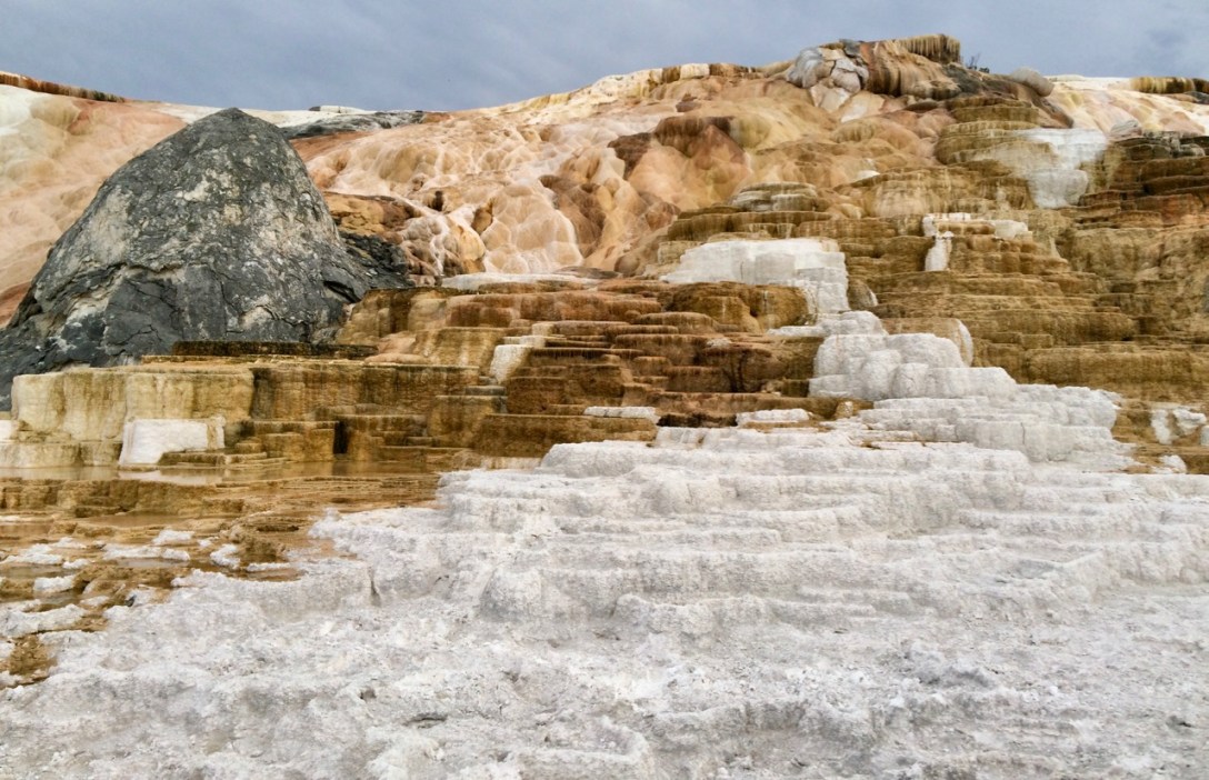
Pic: What on Earth? Palette Spring. Mammoth Hot Springs, Yellowstone NP, WY
Yellowstone is so gigantic that after five days I had barely made a dent — and had yet to see the park’s most famous feature. So, recharged from a few nights in a soft bed, I went back for seconds. With the 4th of July holiday weekend approaching, I walked into the backcountry office with some anxiety.
“This might be a stupid question but… are there any backpacking sites available this week near Old Faithful?”
Clickity-click. “No problem. How’s Thursday and Friday night?”
Boom!
That left me one night to fill. I was headed back toward Gardiner to scout for something in the neighboring National Forest when I noticed something wrong with the sign by Mammoth Campground: it didn’t say CAMPSITE FULL.
I made a hasty left, parked near the entrance, and approached the camp host.
“This might be a stupid question but… do you have a site for tonight?”
“Yup, we’ve got a few.”
Boom!
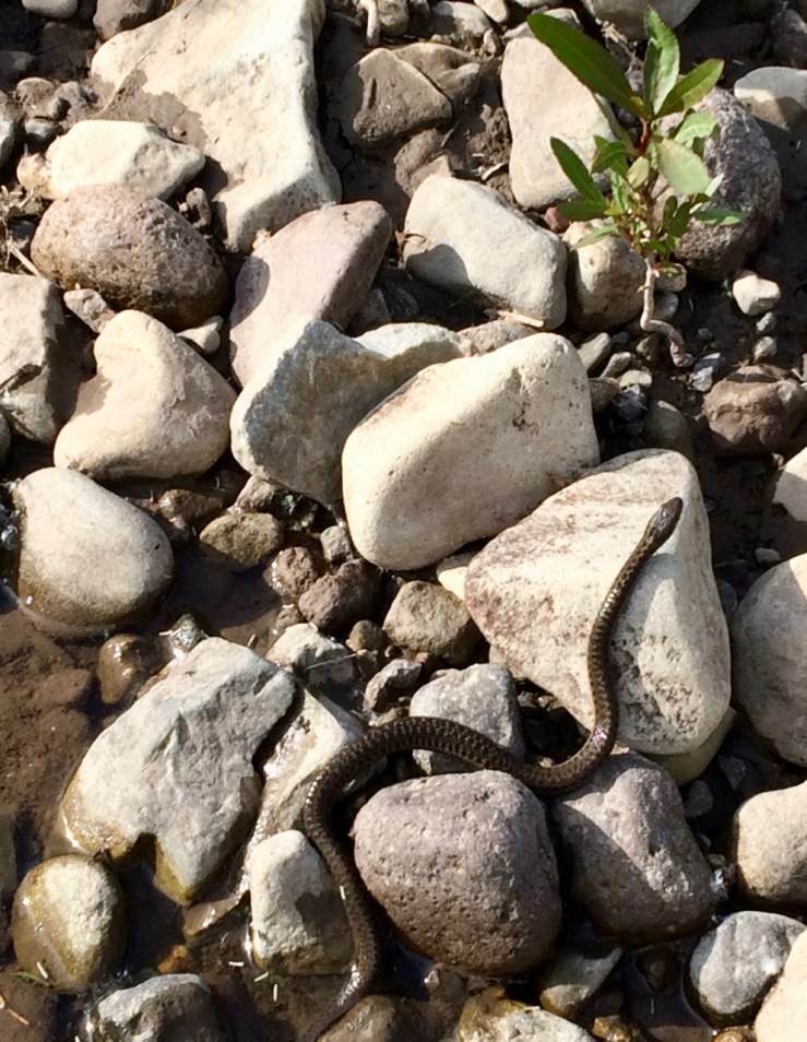
Sleeping arrangements arranged, I was free to splash around in the Gardner River[1] where I met this handsome fellow:
Pic: Terrestrial gartersnake. Gardner River, Yellowstone NP, WY
Then I explored the famous Mammoth Hot Springs, where I met this other handsome fellow:
Pic: Bullsnake. Mammoth Hot Springs, Yellowstone NP, WY
And these otherworldly (there’s that word again) formations:
Pic: Seriously: What on Earth? Minerva Terrace. Mammoth Hot Springs, Yellowstone NP, WY
Readers may be asking themselves something that feels like a stupid question: what on Earth is happening at Mammoth Hot Springs?
As is often the case in Yellowstone, the answer is a unique combination of geology, chemistry, and biology. The terraces, stark white when uncovered, are travertine — dissolved and re-deposited limestone. The rich oranges and browns are mats containing billions of thermophilic bacteria and illustrate the different temperatures of magma-heated water welling up from below[2].
[1] The nearby town is named Gardiner but the river is spelled Gardner in most (but not all) sources. /shrug
Pic: Big Mike the Tyrannosaurus Rex. Museum of the Rockies, Bozeman, MT
I nearly choked on my lunch while flipping through hotel rooms in West Yellowstone. Prices were about twice what I expected to pay, especially given how old most buildings in town appeared. Bozeman was less than two hours away and seemed far more reasonable. I ended up splurging on a Quality Inn in nearby airport/bedroom community Belgrade; at $140/night, it would be my most expensive room of the trip. The bed sure was comfy, though.
The drive took me up US-191, where I learned that the Montana constitution requires its citizens to take up fly fishing. As the highway followed the meandering Gallatin River, every pull-out held a Subaru or a pick-up watching over someone wearing waders and plying a riffle below.
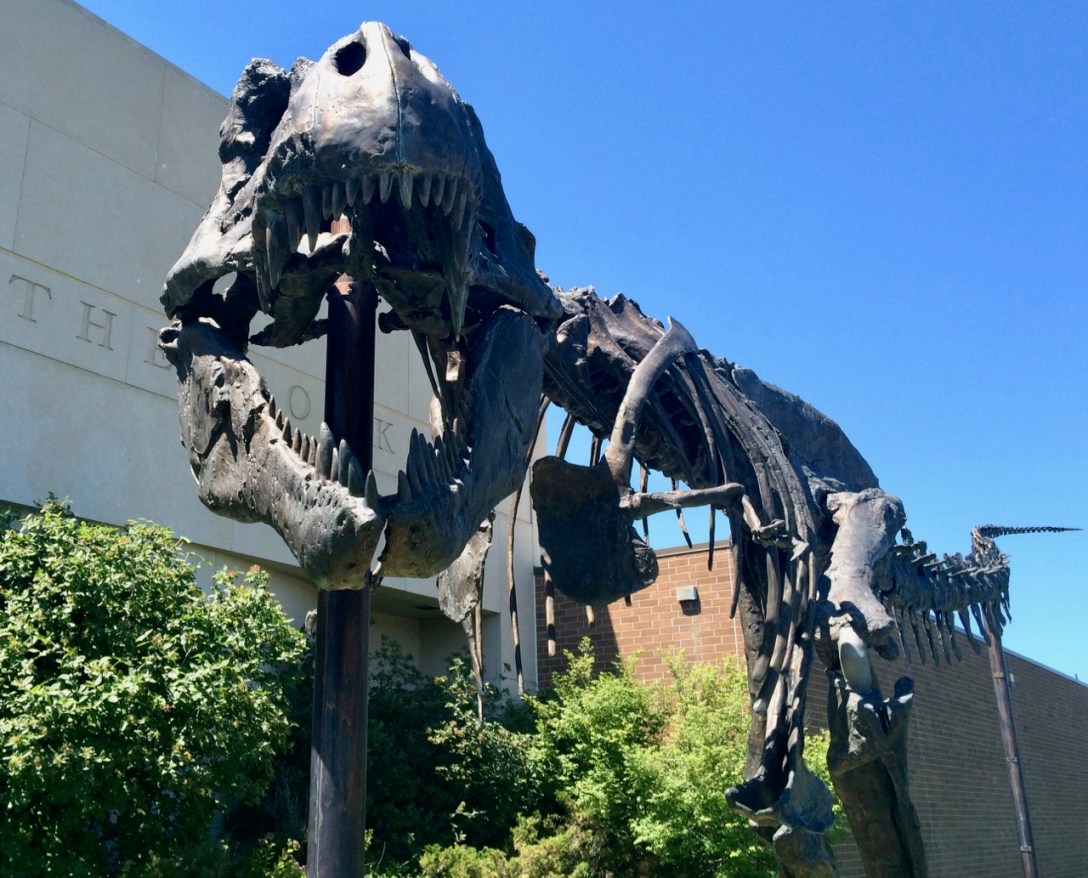
I emailed my friend and former southwestern Montana resident Bill for suggestions to fill my couple days in town. I would eventually do everything on his excellent list, but I started with a cheesesteak from Pickle Barrel and an afternoon at Museum of the Rockies.
Since Bill had limited my search of the extensive sandwich menu to a single entry, my only decision was “small or large?”
“How big are the sizes?” I asked.
“The small is a little over eight inches,” the friendly college-aged woman behind the counter told me.
“Heh, well that’s–”
“–and the large is seventeen inches.”
“Good lo–”
“Here, I’ll show you.” She walked back to a shelf of fresh hoagie rolls and held one up for me.
“Wow, it really is seventeen inches.”
I ordered the small sandwich.
Lunch in hand, I found a shady spot near Big Mike and enjoyed a delicious (if not necessarily authentic) cheesesteak and a few hours in a cool museum with lots of dinosaurs.
Pic: My friend Mike the Samoan power top has the same rule. Museum of the Rockies, Bozeman, MT
These attributes alone would make Yellowstone an unmissable destination, but the valley also contains over 10,000 hydrothermal features, fully half of the world’s inventory. These stinky, steamy, explosive, and colorful oddities are powered by chemistry, heat-loving bacteria, and the Yellowstone supervolcano.
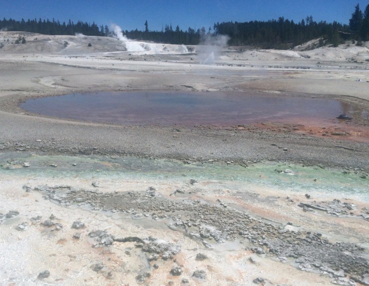
I breakfasted at Grebe Lake, hiked back to Isa, then drove toward West Yellowstone with its restaurants and motels and showers. On the way, I pulled into a very full parking lot at Norris Geyser Basin. “What are all these people doing here?” I wondered. “Oh, right, it’s Sunday.”
I did not yet know of the incredible variety and density of attractions in this literal hotspot. It’s easy to overuse the term “otherworldly” but these few square miles are clearly not business-as-usual for the earth’s surface.
Pic: Whirlygig Geyser and Porcelain Basin. The orange color comes from deposits of iron oxide (“rust”); the green and white in the foreground are thermophilic bacteria. Norris Geyser Basin, Yellowstone NP, WY
Pic: Steamboat Geyser lying in wait. Capable of propelling water over 300′ into the sky, its last eruption was in 2014. Norris Geyser Basin, Yellowstone NP, WY
Pic: Cistern Spring. The different colors come from thermophilic bacteria adapted to different temperatures. Norris Geyser Basin, Yellowstone NP, WY
Eventually, four miles of walking in the sun and the constant rotten-egg smell of sulfur took their toll. I gave the basin one last look, yielded my parking spot to other visitors about to have their minds blown, and headed west toward this-worldly civilization.
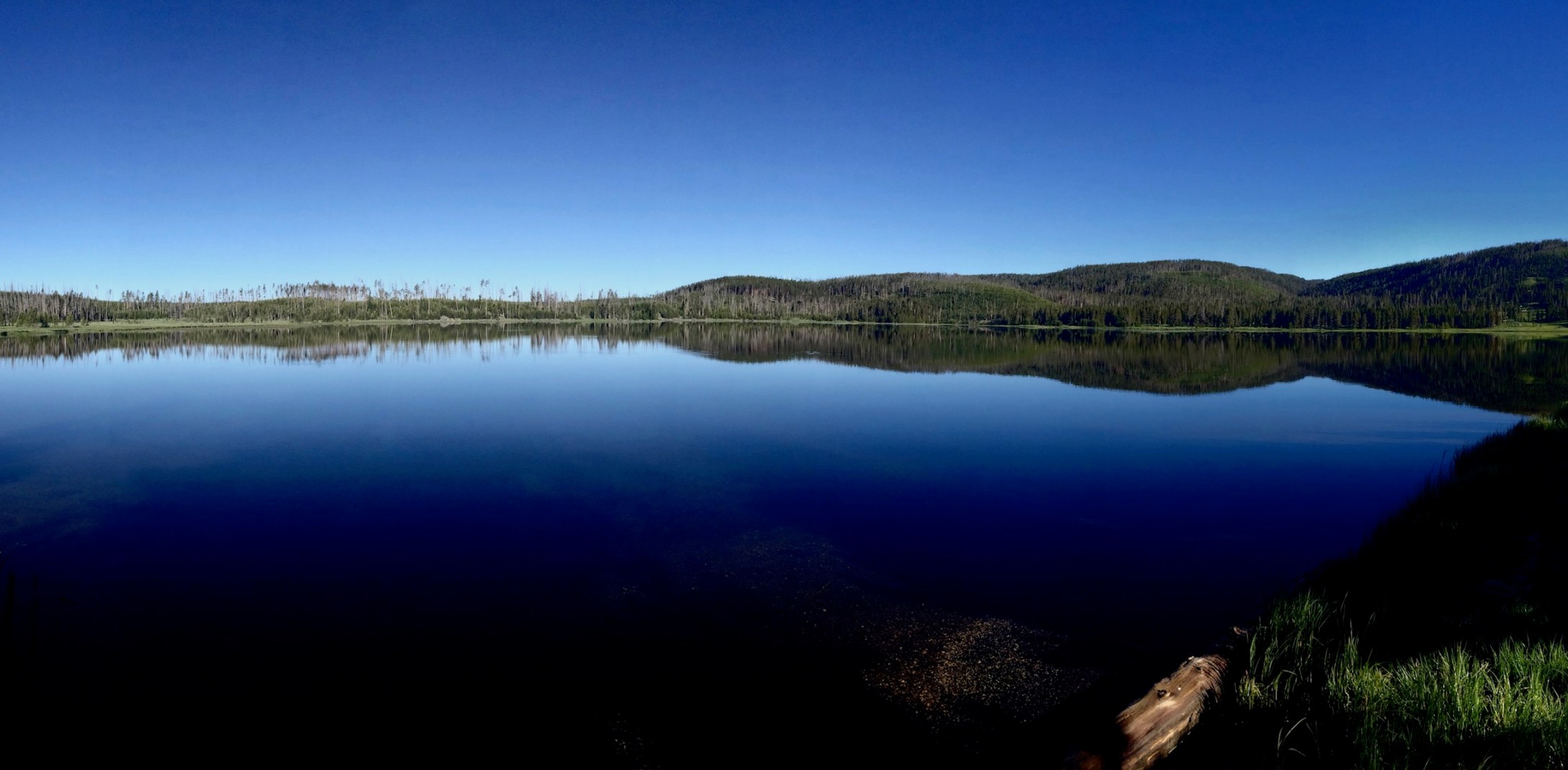
You won’t find Grebe Lake on a postcard in the gift shop, but it was simple and pretty and a great base for hiking Observation Peak.
Originally, I planned to go only as far as Cascade Lake since my National Geographic® Trails Illustrated™ Topographic Map indicated that would be a 7.6 mile journey. Trail signs and my old friend “distance = rate x time”, however, put the round-trip distance at about five miles. I had no excuse for skipping the 875′ climb to Observation Peak and bringing the day to an even ten miles.
Pic: There’s the Grand Canyon of the Yellowstone again. Observation Peak, Yellowstone NP, WY
While not as impressive as the views from Mt. Washburn, the summit provided a different panoramic perspective on the valley. No bighorns up here, though some of the resident marmots were curious and/or concerned about my activities.
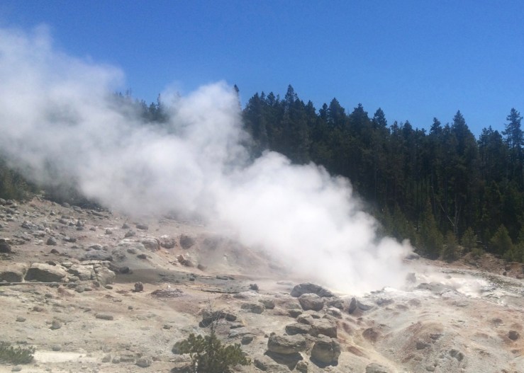
The only agenda item for the day was to get to Grebe Lake and lay low for the weekend. Along the way I got my first real taste of Yellowstone’s geothermal activity in the Mud Volcano area. The variety of bizarre features that result from differing combinations of water, heat, and noxious gases are incredible — even without the thermophiles and explosive pressures that characterize the park’s more famous geological curiosities.
I ate a cheeseburger, stuffed things into my pack, clawed through an absurd cloud of mosquitoes, and after 3.2 mostly flat miles arrived at my home for the next two nights.
Pic: Sign sweet sign. Grebe Lake, Yellowstone NP, WY
Pic: Hey, that’s the name of the park! Yellow stone in the Grand Canyon, Yellowstone NP, WY
One pulled pork sandwich and one cone of Wilcoxson’s Rocky Road devoured, I headed for the Grand Canyon of the Yellowstone River. Viewpoints dot both sides of the stunning gorge, but dinner in Canyon Village started me on the North Rim.
The first trail I found, Brink of Lower Falls, happened to be the highlight of the evening. I was skeptical of its 250 feet of switchbacks after my non-trivial morning, but standing next to millions of gallons of water plunging into the yellow cliffs 300 feet below was a worthy reward.
Vid: A lot of water falling a long way. Check out the leftover snow in the shadows on the north-facing side of the canyon. Brink of Lower Falls, Yellowstone NP, WY
Remember Thomas Moran? One of his most famous paintings is said to come from a sketch Moran made at what is now called Artist Point. That story is apparently apocryphal but the name and the splendor of the view remain.
As the summer sun finally gave up and sank to the west, I arrived at my last stop: Uncle Tom’s Trail. I knew it involved stairs and went down to a view of the waterfall. I also knew that darkness was falling quickly and that I was solo in grizzly country. A guy in the parking lot saw my hesitation and offered this advice: “Eh, you can probably make it. Especially if you have a flashlight.”
I followed the trail down bit by bit, passed a couple on their way back (“Someone doing this even later than us — nice!”), and came to a sign declaring that the last bit was very steep and that returning would be difficult. Challenge accepted.
I enjoyed Lower Falls in the last light of the evening — alone at a popular spot in the most famous park in the world — then trudged five hundred feet back up the stairs and switchbacks to the parking lot. My feet ached from the 10+ mile, 2200+’ day, but at least there was no one on the road at this hour. I zipped through dark forests of lodgepole pine blasting Tool’s Undertow.
I was glad to have a reserved campsite waiting for me. It was nearly midnight by the time I pitched the tent, crawled inside, and crashed.
The day’s first order of business was to find out why I couldn’t camp anywhere last night. I’d seen the camp host walking around so I knocked on the door of his RV and asked why everything was closed.
“Intense grizzly activity,” Gene told me. “A mom with four cubs — usually they only have one or two. I’ve seen ’em on webcam dragging carcasses into the river bed.”
In other words, not a great scenario for tent camping. Since Gene’s campground was one of the few open for non-hardsided camping, I reserved another night at shelterless site #30. At least it would free me to stay out late playing in the park.
Somewhere between bear activity and site reservations Gene proclaimed, unprompted, “I don’t care what kind of environmentalist you are — wolves don’t belong in Wyoming.” I said, after a pause, that I knew ranchers weren’t big fans of the Yellowstone wolves’ recent rebound. Gene only shook his head: “Wolves are killing machines.”
I listened to a few more of Gene’s Wolf Facts, a bonus story about the Buffalo Bill museum displaying a mummified Indian for years despite the horror of the local native population, and an endorsement of Gene’s wife’s Subaru for driving in icy Wyoming winters. Then it was time to hit the park.
I survived my first elk jam in Hayden Valley — some handsome bulls loitering by the side of the road — and proceeded up to Dunraven Pass. When exploring a new area, it’s always nice to ascend to a high point and get the lay of the land. The place to do this in Yellowstone is Mt. Washburn. While the hike’s 6.4 miles[1] and 1400′ of climbing aren’t exactly trivial, the trail is well-routed (it’s an old fire road; chunks of asphalt are still evident in the switchback section) with limited cliff exposure which makes it perfect for families with children or other less-experienced backcountry travellers.
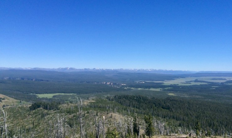
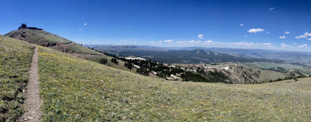
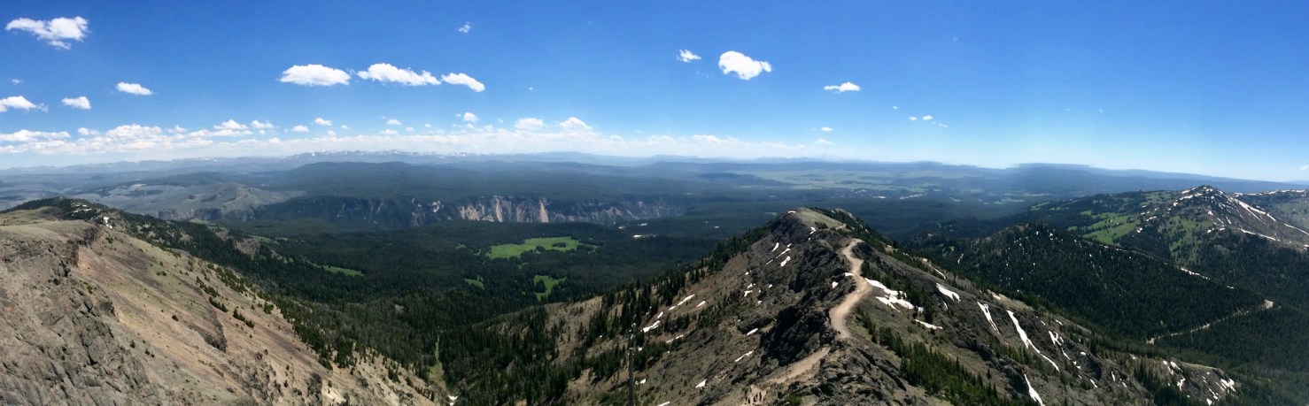
Plus, the rewards are incredible. “Panoramic” is a word that gets thrown around a lot, but the views from the top of Mt. Washburn are truly 360 degrees of spectacle: mindbogglingly expansive meadows stuffed with green grass, snow-capped mountains in all directions, and my first glimpse of the Grand Canyon of the Yellowstone.
Pic: Center left: Grand Canyon of the Yellowstone. Center right: Mt. Washburn trail headed back to the road. View southwest from Mt. Washburn Lookout, Yellowstone NP, WY. Larger image
It was, however, a little breezy at the top. I don’t know how strong wind has to be before it prevents a full-grown adult from walking a broad road in a straight line, but this wind was that strong.
Vid: Panoramic views or shelter from the wind: pick one. Mt. Washburn Lookout, Yellowstone NP, WY
[1] Add 0.5 miles if you arrive late due to an elk jam and have to park in a pullout below the trailhead lot.
Pic: Perfect place for a pic-a-nic basket. West Thumb, Yellowstone Lake, Yellowstone NP, WY. Larger image
The tricky part of Yellowstone, the crown jewel of the national park system, is accommodations. Reservable campsites are booked months in advance. First-come-first-served sites involve getting up super early, waiting in line, and hoping. Motels in the small pockets of civilization surrounding the valley are expensive. Lodges within the park are even more expensive and are booked months in advance.
My secret weapon was backpacking. The requirement to carry everything you need a few miles into the woods is an effective filter for most visitors. With help from the volunteer at the backcountry office and a list I found of easy Yellowstone backpacking trips, I procured Friday and Saturday nights at Grebe Lake
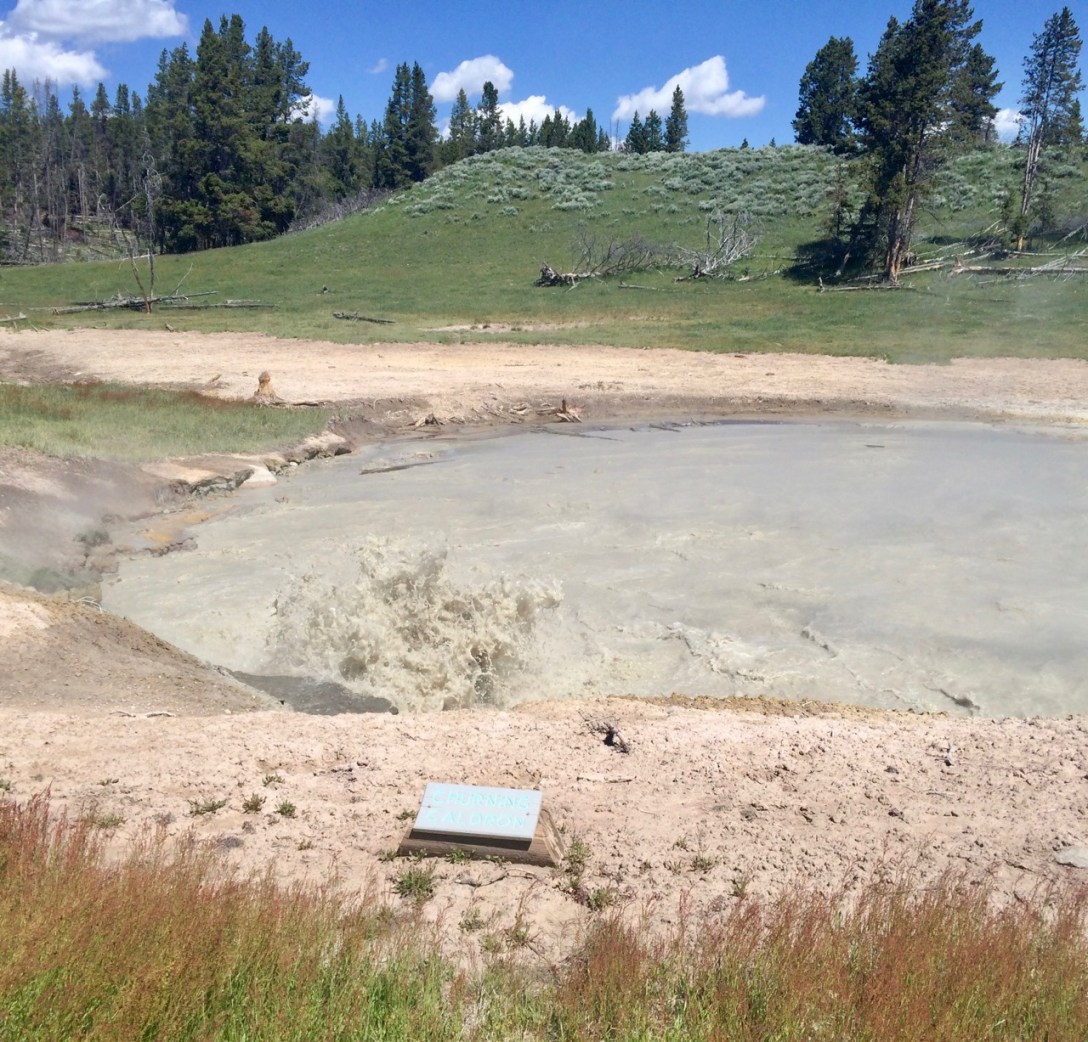
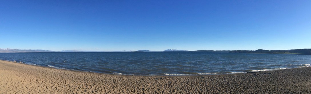
That left me two nights to take care of. I slid over to West Thumb where I enjoyed a mud pot in the parking lot, followed by a quick 2 miles and 400′ to Yellowstone Lake Overlook. There were some minor thermal features, but the big win was the view of Yellowstone Lake — which is enormous! — fringed by distant clumps of mountains. By the time I got back to the car, I had done some math and realized I didn’t have time to do anything but head to the east side and look for camping.
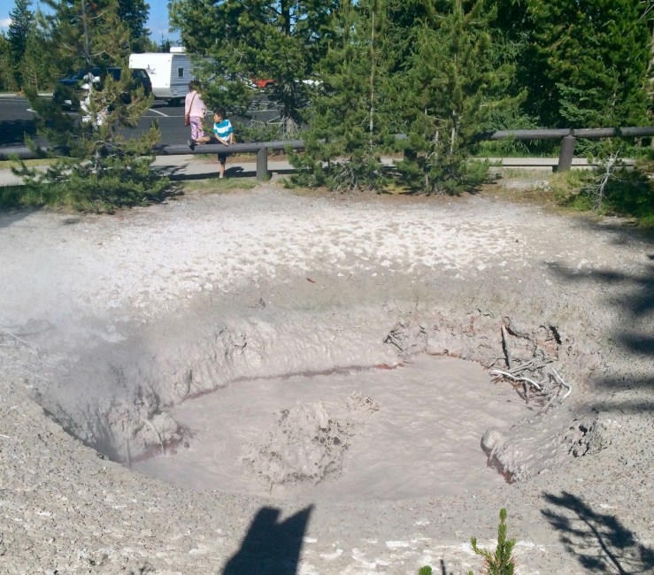
Pic: Puddle of Mudd. Mud pot, West Thumb parking lot, Yellowstone NP, WY
The trip across the park’s absurd breadth left me just enough light to visit every forest road between the east entrance and the town of Wapiti. Result: zero camping. Many roads on the map were so small that I never discovered them (perhaps some turnouts on the highway were listed as “roads”?). More obvious roads were gated off within a half-mile, where camping was not legal or practical. The last road that could reach public land, listed as CR-406 in Google maps but signed CR-4B7 in real life, headed several miles into the hills but ended abruptly at someone’s driveway with clear signs reading PRIVATE PROPERTY and NO TRESPASSING.
Defeated, I returned to a “developed” campground I’d passed up earlier where I paid $10 for a gravel pad, access to a vault toilet, no sun shelter, and no water. As the moon rose over the highway, forty miles from anything and with a huge park for me to start exploring in the morning, it seemed like a bargain.


