Day 003b: Well, There’s Your Problem

Pic: That’ll buff right out

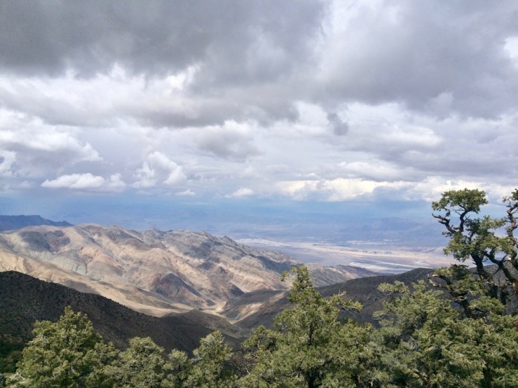
After my hike up Wildrose Peak, I drove back to Thorndike around 1630. There was one guy, camped in my spot from last night. By the time I heated up some potato soup for dinner, all six camp spots were claimed. Miles and Kelly, a couple with an ’87 4WD Vanagon (pimp!), passed by. They explained that they were walking up to check out an RV that had rolled and was blocking the road up to Mahogany Flats and Telescope Peak. When you’re in the woods you make your own fun, so in spite of 8.4 miles of weariness in my feet I made the short uphill trek.

This is what we found:

Day003bBaxterRVThorndike

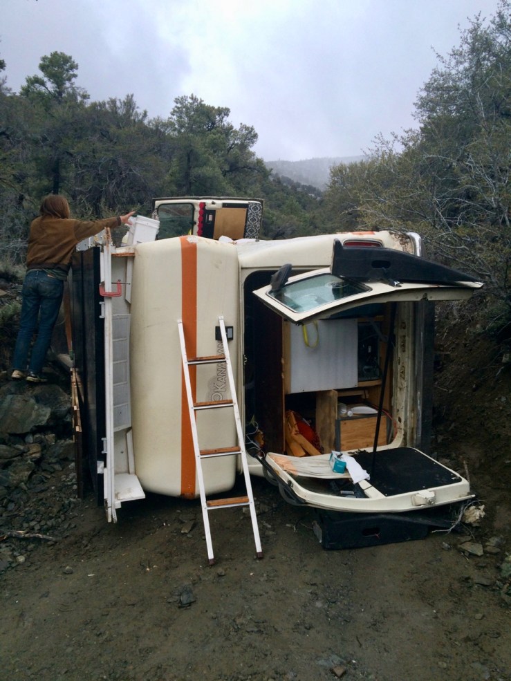
Pic: Baxter shuffling gear

I had admired this rig yesterday as it drove past Thorndike, en route to higher campgrounds and evidently undeterred by the snow and the narrow, steep, occasionally marginal road. They had chains on all four tires so I was pretty sure they had 4WD and a plan.

I helped Baxter and Sam unload stuff for a while asking what happened. Apparently, they were driving up this long incline and had some kind of engine trouble and/or lost traction and started sliding backwards. The driver tried to turn into the hillside to slow their momentum but instead jack-knifed and rolled. Neither of them was hurt.

Eventually, they tracked down a ranger, who called in a tow truck with a winch-thing and another truck with a flatbed:

Day003bRightingRVThorndike

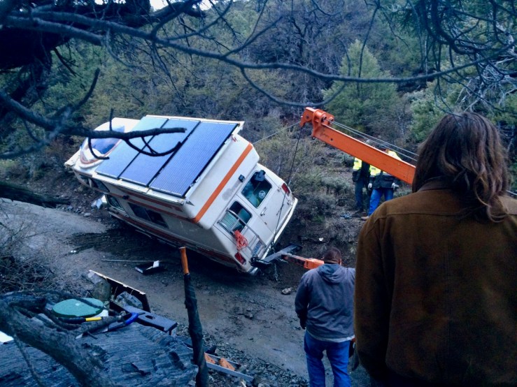
Pic: Here they come to save the day

Sam had spent months preparing this vessel for a long voyage, which Sam and Baxter had begun only a week earlier. They were pretty bummed, obviously — not an auspicious start to their journey!

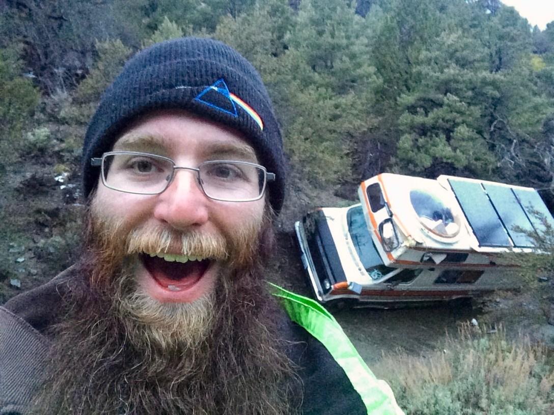
However, the truck operators managed to get the RV upright — they didn’t even scratch the solar panels. Later she would roll down the hill on her own, without the flatbed. Since my biggest concern was for the drivetrain and axels, I think that’s a pretty good outcome. I offered them a little cash to defray the costs of getting four dudes and two heavy trucks from Lone Pine out to the middle of nowhere — my justification for taking a selfie in front of their wrecked dreams.

Good luck, Sam and Baxter. I hope you guys made it back on the road!

Day 003a: Wild Gravity

Pic: Cactus and snow atop Wildrose Peak. Death Valley NP, CA

Inspired by the events at Walker Lake, I pitched my tent under a broad pinyon pine in hopes of shelter in case the weather worsened overnight. When I awoke to raindrops on the roof of my tent, I was disappointed but not really surprised. It was only after I unzipped the flap and got out that I saw that the sky was actually clear, and that the tree I’d sought for shelter was now acting as a snowmelt concentrator. The whole campsite was dry except for broad wet rings around the trees.

Today marked the inaugural hike of the trip: 4.2 miles and 2000 feet up to Wildrose Peak. This was my most strenuous hike in recent memory, but I didn’t put all my junk in storage to shy away from a challenge.

The trailhead begins near some interesting historical artifacts, the Charcoal Kilns:

Day003aInsideCharcoalKiln

Pic: Inside a charcoal kiln. It still smells like a campfire, over one hundred years later

“The Wildrose Charcoal Kilns were completed in 1877 by the Modock Consolidated Mining Company to provide a source of fuel suitable for use in two smelters adjacent to their group of lead-silver mines in the Argus Range west of Panamint Valley, about 25 miles distant from the kilns. Although the mines themselves were worked intermittently until about 1900, there is no clear evidence that the charcoal kilns were operational after 1879. Evidently either other fuel sources were located or it was found to be more profitable to ship the raw ore elsewhere for processing. This short life may help to explain the remarkably good condition of these kilns, more than 100 years after their construction.”

Excerpt from “Charcoal Kilns Historic Structures Report”, 1970

Wildrose Peak has amazing views of the valley and beyond. Unfortunately, these were largely blocked by clouds today. Still, a worthwhile journey to kick off the hiking portion of this adventure.

Day003aDeathValleyFromWildrosePeak

Pic: Looking down from Wildrose Peak

Day 002b: Snow and Hot Chocolate, Ten Miles from the Lowest Point on Earth

Pic: Dr. Hugo Heyrman’s “Lady Desert: The Venus of Nevada”. Rhyolite, NV

At Tonopah, US-95 veered south. As I drove into the heart of the next thunderstorm, easterly wind blew left to right across the highway. When vehicles passed in the opposite direction, they blasted an extra stream of water across my windshield. Since 90% of that traffic was semis, work trucks, RVs, and school buses, the result was that even with my wipers on epilepsy mode I was completely blind for two seconds out of every ten.

Eventually I drove through the end of the storm, down to Beatty, took a quick detour to Rhyolite, and headed into Death Valley.

I stopped at the ranger station in Furnace Creek to buy my Annual Interagency Pass and double-check my plan to camp at Wildrose.

“Are there likely to be a lot of people up there since it’s Friday night?”

“Well that’s an hour away from any ranger,” the woman behind the counter answered, “but no, probably not. It might be snowing, though.”

“…that’s… not necessarily a dealbreaker.”

“Yeah, there’s a 50% chance of rain, which will be snow up there. Do you have four-wheel drive?”

I scouted a few of the lowlands campsites and found them relatively full (at least by my standards). I wanted to check out Wildrose anyway, since it was near the hike I planned to do tomorrow: Wildrose Peak, one of the few hikes in the valley that’s not a short interpretive trail or a monstrous adventure requiring a mule team.

At Emigrant Pass, thunder showers arrived. The rain persisted to Wildrose, where there were also a half-dozen cars. I persevered up a worsening gravel road until I found the Thorndike campground. It was deserted! It was also blanketed in a half-inch of wet snow. So much for the hottest, driest place on earth!

I decided to brave the weather in exchange for less driving and fewer people. Sleeping bag + liner bag + most of my warm clothes made for a passable if chilly night at 7600 feet.

Day002bSandDunesDeathValley
Pic: Sand dunes in the afternoon…

Day002bHotChocolateThorndike
Pic: …snow and hot chocolate by nightfall.

Day 002a: Grant Works as an Example in Almost Any Situation. That’s Grant’s Legacy

Pic: Walker Lake, NV with Mt. Grant hiding in the clouds. Larger image

They looked like good, strong windbreaks.

But around 0500, I was startled awake by reinvigorated wind and rain, this time from the east where my car offered no quarter. I lay drowsing off and on, idly hoping my little REI tent was up to the challenge. The rain settled down a bit, but then I woke half an hour later to howling wind from the west! How does that even work — there’s a huge mountain, to say nothing of the Sierra Nevada, over there. How is that not a better windbreak than a 2003 Subaru? Also, isn’t this a desert? Isn’t it basically summer? wtf.

Eventually, the storm passed and I napped for a few more hours. The tent held up like a champ (thanks REI).

Next stop: Death Valley National Park.

Day 001: Tip-Top, Ready to Go, Go, Go

Pic: Isa is packed! Outside my storage unit, Livermore, CA

I spent a few final hours with reliable power and internet to do backups and download some maps of Death Valley, said goodbye to Kiel and Cheryl’s dog, retraced my steps back to Kirkwood, then pressed on to Walker Lake. Between first dinner in Waterloo, a pit stop at my PO box in Kirkwood, second dinner in Gardnerville, and intermittent drizzle and rain and flurries, I arrived at Twenty Mile Beach well after dark.

Walker Lake is a surprisingly large body of water tucked underneath Mt. Grant and US-95 to the west. When I found a spot away from the few RVs already parked for the night, I hopped out and was nearly knocked over by the wind whistling down the valley from the north. Scouting in the dark is never easy, but this is a lake bed in the high desert so I knew shelter would be in short supply. I found a small thorny bush to form a partial eastern fence and parked my car next to it, forming a stout barrier from the strong northerly wind. This worked well enough to set down my tarp without it blowing away. Half an hour later, I zipped into my sleeping bag and passed out without so much as a single episode of Survivor.

Day001-WindbreakProofOfConcept

Pic: Windbreak, proof of concept.

Day 000: The Saga Begins

Hiking toward Thunder Mountain with Jon on the last day of skiing for the 2015-2016 season.

Pic: Hiking toward Thunder Mountain (near Kirkwood, CA) with Jon on my last day of skiing for the 2015-2016 season

At the end of 2015, I quit my job and spent four months skiing at Kirkwood. Then, one year ago today, I set off on an open-ended road trip through the American Mountain West. When I left, there were two dates on my calendar: a Flaming Lips concert at Denver’s famous Red Rocks Amphitheater, and the day the spreadsheets said I would run out of money.

For the next few months, I’ll be posting pictures and stories I accrued last summer while hiking, backpacking, and road-tripping through brilliant Utah sandstone, imposing Colorado granite, and the endless skies of Wyoming and Montana. I hope they provide inspiration for the adventures in your life!