Day 009b: No Stairway? Denied!

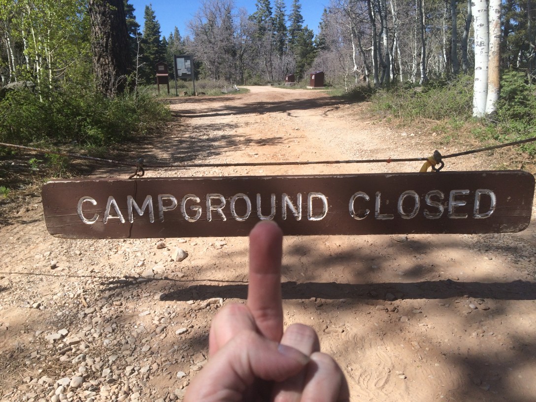
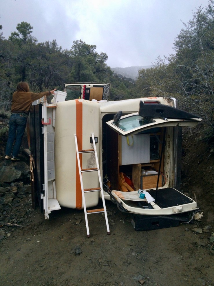
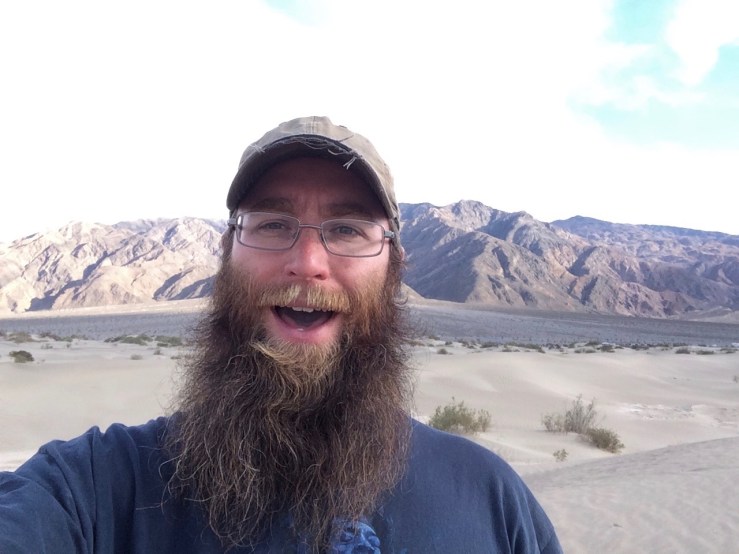
Pic: To be fair, it probably would have been full by the time I got here anyway. Lava Point CG, Zion NP, UT

My longer-than-planned stay in the relative luxury of Las Vegas had me rolling into the US’s 5th most popular national park on a Friday evening — not exactly Plan A. My research surfaced a couple camping possibilities away from the likely-busy Kolob Canyons and the 100%-certain-to-be-mobbed main canyon. After a gigantic carnitas burrito in St. George, I took a poorly-marked left off of UT-9 and headed for the narrow connective tissue between Zion’s hemispheres.

A quick detour down some well-maintained hardpack led me to the inexplicably closed Lava Point Campground. I expressed my feelings about this discovery in the picture above and pressed on to Kolob Reservoir. I crept around the good but worsening road that meandered along the shore, looking for a viable spot to set up camp. If I couldn’t find something up here, I’d have to backtrack to the highway and find space in an overcrowded commercial campsite or overpriced motel.

After a couple of mildly technical sections, I arrived at a non-trivial pool covering the breadth of the road. Campsite-less and perhaps a bit carelessly, I studied the obstacle, lined up, and plunged ahead. The water was deeper and the bottom muddier than I anticipated, but with a little luck, a little skill[1], and that legendary Subaru All-Wheel Drive[2], Isa made it through without a problem (as long as you don’t consider wheel wells filled with mud to be a problem).

[1] The “skill” here is keeping even pressure on the gas, making small adjustments, and keeping the front end in front of the back end. Put another way: jus’ keep goin’.

[2] Subaru, give me free stuff!

The surprise mud pit turned out to be a blessing. Combined with an aspen that had fallen across the road further south, it shielded a pair of campsites from the RVers, kayakers, and anglers who were up here getting an early start on the weekend.

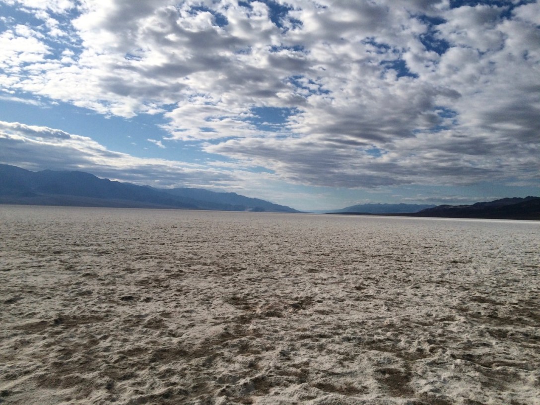
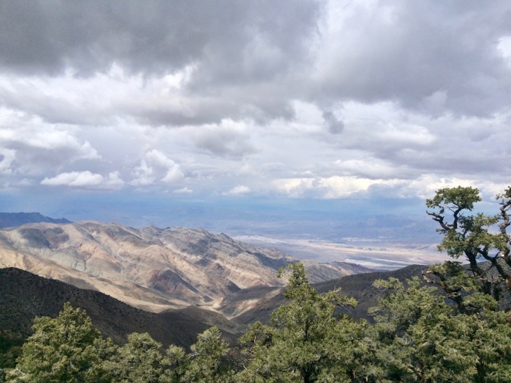
And rightfully so. As a Southern California boy, when I hear “reservoir” I imagine a concrete-banked expanse of brownish-green water bounded by an asphalt multi-use path. Kolob Reservoir was… not like that:

Day009bKolobReservoirPano

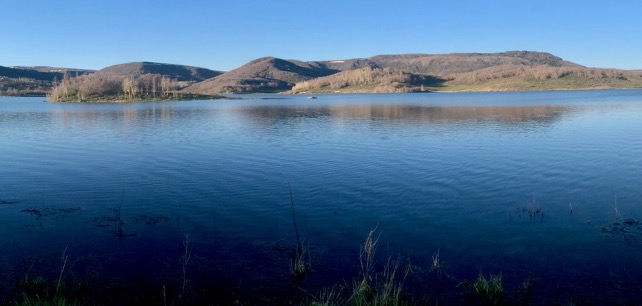
Pic: Still a little snow hiding out under the ridges, above 9000′. Kolob Reservoir, UT

I set up camp, then watched in awe as an osprey circled, stalled into a vertical dive, plucked a fish out of the water, and flew away on a half-dozen beats of its enormous wings.

Later, I heard another vehicle braving the sippy hole. A Jeep emerged and occupied the other protected site. I chatted with the pilot, a twentysomething fisherman I’d seen trying his luck earlier, while he chopped firewood. I learned that his name was Derek, he lived in St. George, loved the Zion area, and was a “conservative libertarian”. I introduced myself as a “socialist hippie”. We got along famously. He shared his fire and knowledge about the area. I gave him some bread when he realized he’d forgotten to bring buns to go with his campfire-roasted brats. We discussed his observation that Nevada was perhaps the most libertarian of the fifty states, yet almost all of its land is owned by the Federal government. As I bid him good evening and headed for bed, he produced a guitar and sang Lynyrd Skynyrd’s “Simple Man” in a tenor that was surprisingly sweet for a libertarian.

Overall, a pretty good start to an exploration of Utah’s crown jewel.

Day 008b: Sleep Now in the Fire

Pic: The agents of orange, perhaps. Valley of Fire SP, NV

The word of the day is atlatl. Atlatl!

I was prepared to be underwhelmed by Valley of Fire after a lackluster drive to the entrance area. But somewhere around the narrows of the White Dome Loop hike, I became whelmed. It’s like nearby Red Rock NCA (where I cut my teeth on desert hiking during the Vegas years) only bigger and weirder. Sandstone!

I felt like kind of a warm weather wuss after getting worn out from fifteen minutes of mild bouldering in Mouse’s Tank (and BTW what a terrific place to (allegedly) hide from a posse — that’s some Monkey Wrench Gang shit.) But then Isa’s thermometer said 95F and I was like that’s actually pretty hot. Also I failed pretty hard at hydrating. Water!

I didn’t exactly plan it this way (least necessary disclaimer ever?) but dinner ended up being grocery store chicken strips and donuts. Smith’s!

Day 008a: The Call is Coming from Inside the Hotel!

Pic: Symmetry is creepy. The Orleans, Las Vegas, NV

As I lay in my gambling-subsidized bed contemplating the next phase of my journey, the room phone rang. “Uh, hello?”

“Hi, this is security.” (Uh-oh, what’d I do…) “We noticed that you’ve had the ‘Do Not Distrub’ sign on your door for a few days and just wanted to make sure everything is okay.”

Las Vegas: where using the same two towels for four days is a potential emergency.

Day 006: Searchin’ for My Lost Bucket of Salt

Pic: Talk about mud flaps, my drink’s got it. Walmart, Las Vegas, NV

I surveyed one Tyler and two friends of Tyler. Top five answers are on the board.

What are your favorite parts of this product?

5. Dispensa-Rita®, liquor maid! Where would I be without you?

4. Big Bucket (“Then it’s not just a clever name”) and Premium — that’s a marriage made in Walmart (h/t @dabizomb)

3. Master of Mixes is pulling your strings / Twisting your limes and salting your rims

2. Is this product marketed to alcoholic doomsday preppers? (h/t @mpricer)

1. In the highly-competitive margarita bucket market, I’d hate to be America’s second-favorite. (Actually, they finished second in the polling, after “What?”)

Day 005: You Get *Four* Cards

Pic: Vegas-area limit poker enthusiasts should be able to pinpoint this location to within a few feet. Las Vegas, NV

My plan was to take a break from walking by staying in Vegas for a few nights. It didn’t take long to remember that was a stupid idea. The Donald Trump-sized blister on my foot was not amused with the endless hallway that lead to my room. (It was quiet down on the corner, however, so worth the prolonged limp.)

Long ago, I lived here in the desert and played poker regularly. I don’t miss either of those things, but I enjoy visiting now and then — especially in a poker market with enough density to support a few non-Holdem games. Vegas is one of those markets and The Orleans is the last bastion of Omaha/8 in the valley. Omaha/8, if you don’t know, is just like Holdem except you get more cards, the pot is split between the best hand and the worst hand, and it is only played by people born before or during the Coolidge administration.

The poker room at the Orleans — catering, presumably, to the blue-haired regulars that keep the games running — had Fox News on one of the TVs, covering the West Virginia primaries. They had some WV legislator talking about how the only candidate he could support was Trump because Trump is for coal, which he called “the most sustainable energy source”. I chuckled aloud (you keep using that word…), but everyone thought I was laughing at the flop action on an 865 rainbow board.

Day 004: Like Being Low

Pic: Badwater Basin, lowest point in North America. (Much) larger image

I don’t know what I thought Death Valley would be like, but it was not what I expected. Even as an experienced desert recreationalist I was blown away by the varied and stunning views from Aguereberry Point, Artists Drive, and Zabiskie Point as well as the contrast between snow in the morning and Badwater Basin an hour away: hot, barren salt flats covering the lowest point in North America.

After a long day of driving between these short excursions, I was surprisingly pleased to re-enter civilization (for values of “civilization” that include Pahrump and Las Vegas), if only because it promised a trip to In-N-Out.

GreatBasinCollaredLizard

Pic: Meeting the locals. Great basin collared lizard

Day 003b: Well, There’s Your Problem

Pic: That’ll buff right out

After my hike up Wildrose Peak, I drove back to Thorndike around 1630. There was one guy, camped in my spot from last night. By the time I heated up some potato soup for dinner, all six camp spots were claimed. Miles and Kelly, a couple with an ’87 4WD Vanagon (pimp!), passed by. They explained that they were walking up to check out an RV that had rolled and was blocking the road up to Mahogany Flats and Telescope Peak. When you’re in the woods you make your own fun, so in spite of 8.4 miles of weariness in my feet I made the short uphill trek.

This is what we found:

Day003bBaxterRVThorndike

Pic: Baxter shuffling gear

I had admired this rig yesterday as it drove past Thorndike, en route to higher campgrounds and evidently undeterred by the snow and the narrow, steep, occasionally marginal road. They had chains on all four tires so I was pretty sure they had 4WD and a plan.

I helped Baxter and Sam unload stuff for a while asking what happened. Apparently, they were driving up this long incline and had some kind of engine trouble and/or lost traction and started sliding backwards. The driver tried to turn into the hillside to slow their momentum but instead jack-knifed and rolled. Neither of them was hurt.

Eventually, they tracked down a ranger, who called in a tow truck with a winch-thing and another truck with a flatbed:

Day003bRightingRVThorndike

Pic: Here they come to save the day

Sam had spent months preparing this vessel for a long voyage, which Sam and Baxter had begun only a week earlier. They were pretty bummed, obviously — not an auspicious start to their journey!

However, the truck operators managed to get the RV upright — they didn’t even scratch the solar panels. Later she would roll down the hill on her own, without the flatbed. Since my biggest concern was for the drivetrain and axels, I think that’s a pretty good outcome. I offered them a little cash to defray the costs of getting four dudes and two heavy trucks from Lone Pine out to the middle of nowhere — my justification for taking a selfie in front of their wrecked dreams.

Good luck, Sam and Baxter. I hope you guys made it back on the road!

Day 003a: Wild Gravity

Pic: Cactus and snow atop Wildrose Peak. Death Valley NP, CA

Inspired by the events at Walker Lake, I pitched my tent under a broad pinyon pine in hopes of shelter in case the weather worsened overnight. When I awoke to raindrops on the roof of my tent, I was disappointed but not really surprised. It was only after I unzipped the flap and got out that I saw that the sky was actually clear, and that the tree I’d sought for shelter was now acting as a snowmelt concentrator. The whole campsite was dry except for broad wet rings around the trees.

Today marked the inaugural hike of the trip: 4.2 miles and 2000 feet up to Wildrose Peak. This was my most strenuous hike in recent memory, but I didn’t put all my junk in storage to shy away from a challenge.

The trailhead begins near some interesting historical artifacts, the Charcoal Kilns:

Day003aInsideCharcoalKiln

Pic: Inside a charcoal kiln. It still smells like a campfire, over one hundred years later

“The Wildrose Charcoal Kilns were completed in 1877 by the Modock Consolidated Mining Company to provide a source of fuel suitable for use in two smelters adjacent to their group of lead-silver mines in the Argus Range west of Panamint Valley, about 25 miles distant from the kilns. Although the mines themselves were worked intermittently until about 1900, there is no clear evidence that the charcoal kilns were operational after 1879. Evidently either other fuel sources were located or it was found to be more profitable to ship the raw ore elsewhere for processing. This short life may help to explain the remarkably good condition of these kilns, more than 100 years after their construction.”

Excerpt from “Charcoal Kilns Historic Structures Report”, 1970

Wildrose Peak has amazing views of the valley and beyond. Unfortunately, these were largely blocked by clouds today. Still, a worthwhile journey to kick off the hiking portion of this adventure.

Day003aDeathValleyFromWildrosePeak

Pic: Looking down from Wildrose Peak

Day 002b: Snow and Hot Chocolate, Ten Miles from the Lowest Point on Earth

Pic: Dr. Hugo Heyrman’s “Lady Desert: The Venus of Nevada”. Rhyolite, NV

At Tonopah, US-95 veered south. As I drove into the heart of the next thunderstorm, easterly wind blew left to right across the highway. When vehicles passed in the opposite direction, they blasted an extra stream of water across my windshield. Since 90% of that traffic was semis, work trucks, RVs, and school buses, the result was that even with my wipers on epilepsy mode I was completely blind for two seconds out of every ten.

Eventually I drove through the end of the storm, down to Beatty, took a quick detour to Rhyolite, and headed into Death Valley.

I stopped at the ranger station in Furnace Creek to buy my Annual Interagency Pass and double-check my plan to camp at Wildrose.

“Are there likely to be a lot of people up there since it’s Friday night?”

“Well that’s an hour away from any ranger,” the woman behind the counter answered, “but no, probably not. It might be snowing, though.”

“…that’s… not necessarily a dealbreaker.”

“Yeah, there’s a 50% chance of rain, which will be snow up there. Do you have four-wheel drive?”

I scouted a few of the lowlands campsites and found them relatively full (at least by my standards). I wanted to check out Wildrose anyway, since it was near the hike I planned to do tomorrow: Wildrose Peak, one of the few hikes in the valley that’s not a short interpretive trail or a monstrous adventure requiring a mule team.

At Emigrant Pass, thunder showers arrived. The rain persisted to Wildrose, where there were also a half-dozen cars. I persevered up a worsening gravel road until I found the Thorndike campground. It was deserted! It was also blanketed in a half-inch of wet snow. So much for the hottest, driest place on earth!

I decided to brave the weather in exchange for less driving and fewer people. Sleeping bag + liner bag + most of my warm clothes made for a passable if chilly night at 7600 feet.

Day002bSandDunesDeathValley
Pic: Sand dunes in the afternoon…

Day002bHotChocolateThorndike
Pic: …snow and hot chocolate by nightfall.