Day 014a: Road to Nowhere

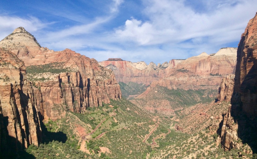
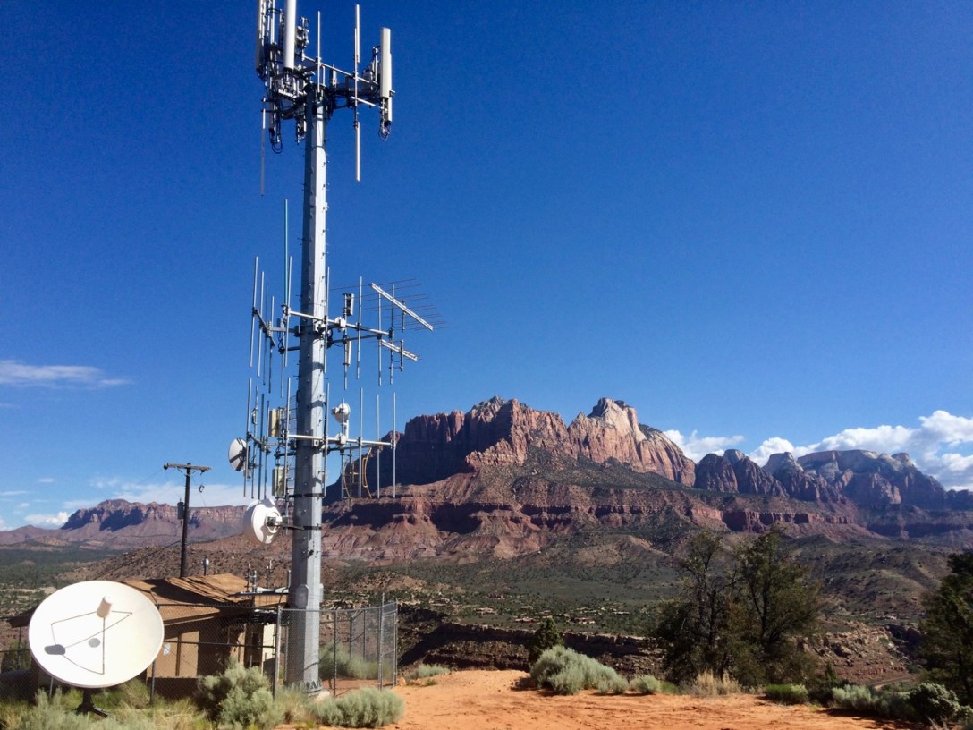
Pic: Zion-Mt. Carmel Highway. Canyon Overlook, Zion NP, UT

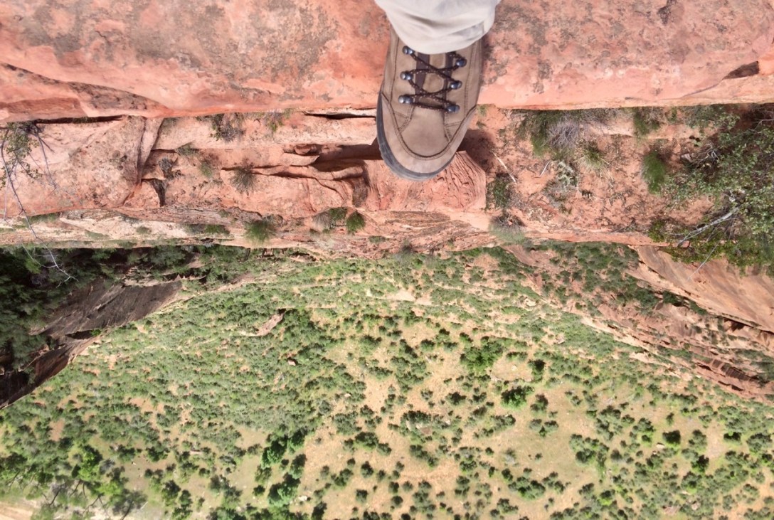
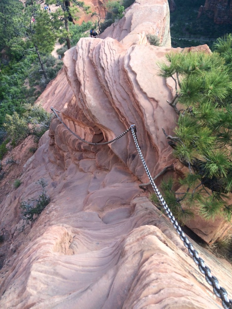
With Angels Landing summited, there was little left to do but exit to the east en route to other glorious Utah parks. On the way, I accidentally encountered another brilliant achievement in civil engineering, the Zion-Mt. Carmel Highway and Tunnel. Using Roaring Twenties technology, two federal and one state government organization collaborated with four private road crews to build a 25-mile road over slickrock, up sandstone cliffs, and 1.1 miles through the side of a mountain in two years and ten months. They even built windows:

Day-014a-Tunnel-Window

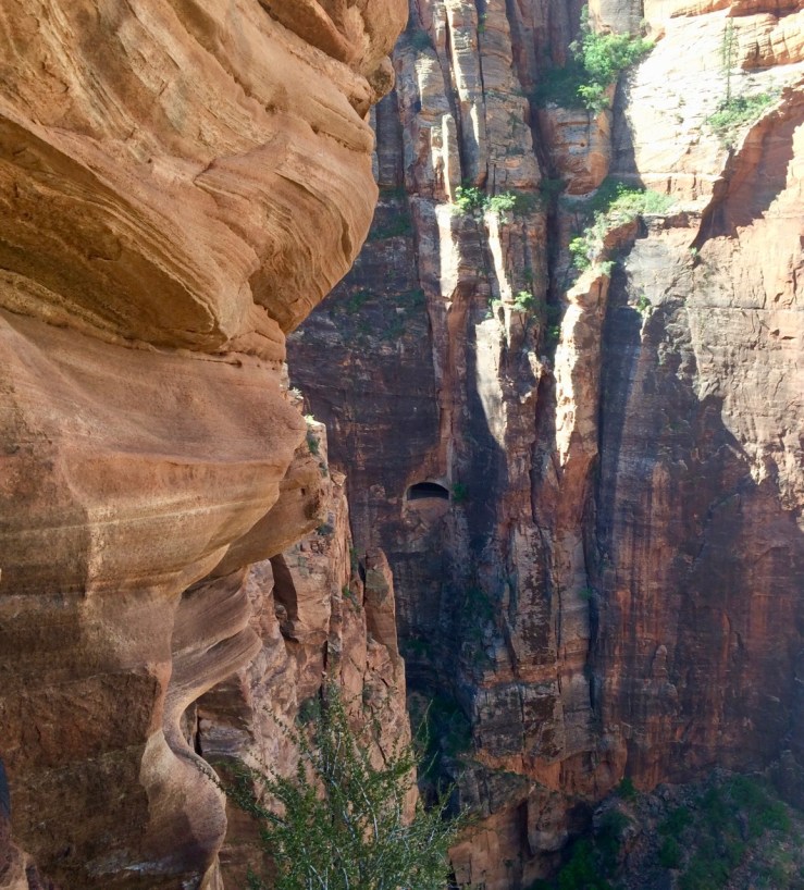
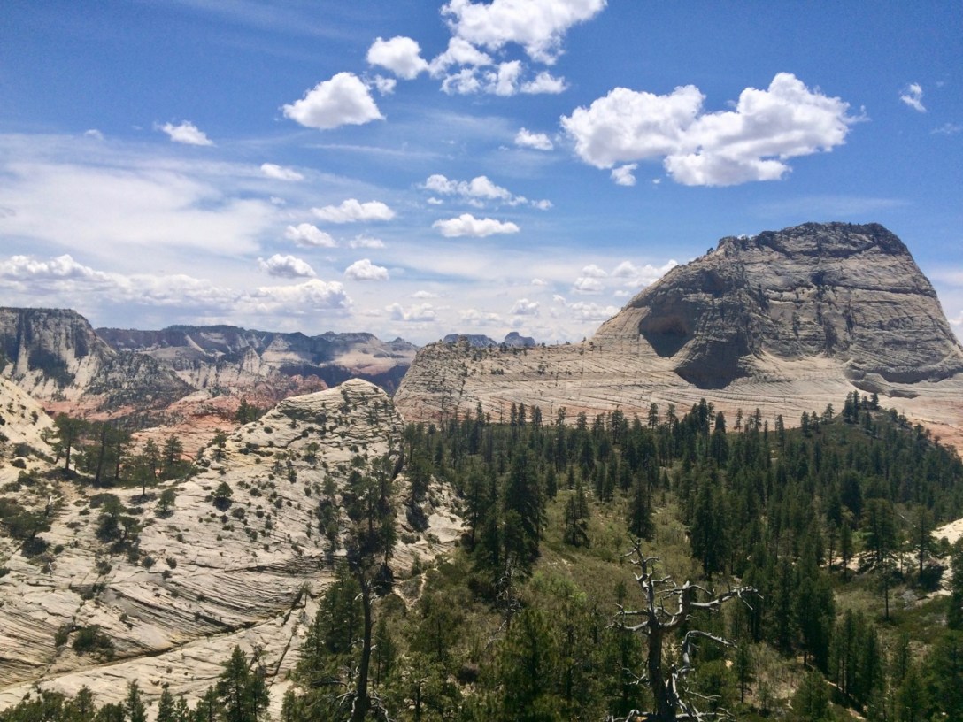
Pic: The dark feature just below center is a two car-length by two person-height window into a 1.1 mile tunnel through the side of a 6200′ mountain. Zion NP, UT

Theoretically the tunnel is large enough to allow two-way traffic, but in practice the number of RVs touring this part of the country in mid-May means that the tunnel sees a lot of alternating one-way traffic. Rangers are therefore employed as flaggers, and the one on the east side looked bored so I asked her about accomodations in Mt. Carmel Junction vs Kanab. She confirmed my suspicions: “For one thing, Kanab has a grocery store,” she explained.

She also confirmed that Kanab rhymes with Donovan MCNABB, the town of Hurricane is pronounced HURRIC’N, and Zion rhymes with LION — not ION — and is definitely not plural or possessive (apparently “ZI-ahnz”, as if the park belongs to a guy named Zion, is a common mangling).

Day 013c: The Money Shot

Pic: Zion Canyon from Angels Landing, Zion NP, UT

The problem with Utah is that pictures — especially my crappy iphone pictures — don’t do it justice. I’ve been lucky enough to visit some incredible places, but I think the top of Huayna Picchu overlooking an abandoned Incan city in the Andes is the only thing I’ve experienced that compares to being on the tip of Angels Landing. (Yes, I scrambled out past the cairns, all the way to the edge.)

After my early start and consequent early finish, I rounded out the day at the Springdale Public Library. I relaxed in a comfortable chair and watched a thunderstorm blow through the valley while backing up my laptop, catching up on email, and flipping through a book illustrating the birds of Zion. #ThanksBenFranklin

Day 013b: Livin’ on the Edge

Pic: Tell me what you think about your situation. Angels Landing, Zion NP, UT

Everything went single-threaded for the last half-mile. Queues began to form before narrow, steep, and tricky sections:

Day-013b-Angels-Landing-Chain-Descent

Pic: Oh, good morning, Mr. Tyler. Going… _down_? Angels Landing, Zion NP, UT

I was glad for my early start, especially as I descended through droves of hikers headed up for lunch.

Most people were pretty good about letting faster folks (like me!) pass. But on a section like this with room for only one hiker at a time, there’s always a guy who comes right up to the bottom of the narrow staircase while I’m in the middle of it. I continue to descend — because what else am I gonna do? — until I’m standing right in front of him and he always looks surprised. Like, my gosh, how could I have possibly anticipated that we would be in each other’s way here? I thought maybe you would vanish, or fly off the mountain like a bird before we literally bumped into one another at this constriction.

My enthusiasm for Angels Landing in spite of all the traffic underscores what an incredible hike it is.

Day 013a: Wiggle Wiggle

Pic: Don’t stop movin’ baby. Walter’s Wiggles, Zion NP, UT

No trip to Zion is complete without tackling the 4.8 mile, 1500′ round trip to the top of Angels Landing. All my friends who had visited the park told me about it. I overheard people talking about it on the shuttle and at restaurants in Springdale. It is so popular yet so can’t-miss that I did something uncharacteristic to prepare for it: I set an alarm.

I passed a couple in their thirties at the start of the Wiggles. “Look, honey, it’s John Muir!” Their kids had just finished a national parks project in school and… allegedly I looked like John Muir.

As a Californian who enjoys the outdoors, I was familiar with his general badassery, but I don’t think I’d ever seen a picture. (Now that I have: other than the beard, I’m not really seeing it.) Regardless, I posed for a photo with my new friends employing what I hoped was a wistful, John Muir-esque look.

I didn’t come on this hike for the civil engineering, but I must give a shout-out to Walter’s Wiggles for being both functional and attractive without distracting from the surrounding beauty. Turns out Walter Ruesch, who designed and lead construction on the project in 1925, was a bit of a badass himself:

The trail was built primarily by hand. Workers earned $3.50 a day to hang precariously off cliff faces and pry at sandstone with jackhammers. Horses and mules rounded out the construction crew, hauling materials endlessly up and down the trail.

Ruesch’s desire to see a trail up Angels Landing came with one caveat. He said, “Zion is God’s country; don’t make it look like hell.” As a result, the trail was build from native material and blended into the cliff.

Angels Landing eHike[1]

[1] “eHike”? lol NPS. Oh, also it’s Flash-only. Sorry; it was the best source I could find.

After the Wiggles I arrived at Scout’s Lookout, where the real fun begins. As the park service explains:

Day-013a-Angels-Landing-Sign

Pic: Remain seated please. Permanacer sentados por favor. Scout’s Lookout, Zion NP, UT

Day 012b: Should We Talk About the Weather?

Pic: Waiting five minutes. Kayenta Trail above Virgin River, Zion NP, UT

In Seattle, they have a saying: ‘If you don’t like the weather, wait five minutes and then shoot yourself in the face.’ –Doug Benson

On the way up to the Emerald Pools, the intermittent drizzle that had characterized the morning became a full-on thundershower. I found a hidey-hole between a rock and a cottonwood and ate Goldfish for twenty minutes until it passed.

Day-012b-Danger-Beyond-This-Point

Pic: Hey, that’s the name of the blog! Emerald Pools Trail, Zion NP, UT

Day 012a: Can You Hear Me Now?

Pic: Five bars of LTE. Cell tower and Mt. Kinesava, Rockville, UT

My server at dinner last night, Rich, was well-versed in dispersed camping on the south side. He suggested a road — washed out in only a couple places — that led to a high bluff above the valley. The camping spots were small and awkward but the place was deserted and provided me all the mobile bandwidth I could eat.

Today’s plan was to knock out some of the short/famous/popular hikes in the main canyon: Riverside Walk, Weeping Rock, Emerald Pools. I was initially skeptical of Zion’s mandatory-during-the-busy-season shuttle system but it actually worked really well. Look at all the cars it kept out of the park:

Day-012a-Shuttle-Line-South-Entrance

Pic: Is this the line for Space Mountain? Shuttle stop at South Entrance, Zion NP, UT

Day 011b: What Did the Five Finger Canyons Say to the Face?

Pic: Beatty Point, Nagunt Mesa, and Timber Top Mountain. Kolob Canyons, Zion NP, UT. (Much) larger image

I wrapped up the afternoon on quick-and-easy Timber Creek Overlook Trail to, as Joe’s Guide puts it, watch “the Finger Canyons get the last direct sunlight of the day.” On the way up, I passed a mom who gathered her brood of young children to let me pass (thanks!). A little boy, maybe four, walked ahead of the group. “What’s up, little man?” I said as I passed.

The kid didn’t even look at me, but ran back to his mom yelling excitedly: “He talked to me!”

As the shadows lengthened in the canyon, I drove back to I-15 then around to Springdale for dinner at Wild Willie’s. I wanted the french dip or pulled pork but they stopped serving “sandwiches” at 1800 (wtf), so I had a $13 bacon cheeseburger instead. I devoured every scrap plus every french fry plus the pickle.

Day 011a: Room with a View

Pic: Tucupit Point from Middle Fork Taylor Creek, Zion NP, UT

INT. KOLOB CANYONS VISITOR CENTER – DAY

Tyler approaches the information desk:

TYLER

Hi, do you know why Lava Point Campground is closed?

RANGER

[without hestitation] Snow.

TYLER

… Let me show you a picture

***

I took Taylor Creek Trail up to Double Arch Alcove. It was cool — cathedral ceilings dripping with moisture — but busy and loud. I continued up the middle fork of Taylor Creek, met a guy on his way out who pointed me to a cute mini slot canyon with a dribble of a waterfall, and finally discovered my own private amphitheater where I enjoyed lunch sheltered from the afternoon sun and with a view of sheer orange cliffs. On the way back down, I encountered a trio of women in their 50s headed up the creek bed.

“Are you a mountain man?” is how they greeted me.

“Well these are mountains and I am a man so… sure?”

They wanted to know what lay ahead. I told them about the cute mini slot canyon and my lunch spot and wished them good luck.

Day 010b: Do Not Pass Go

Pic: Do not collect $200. Virgin, UT

Derek from St. George didn’t have firsthand knowledge of camping options near the Kolob Canyons section of the park I planned to visit the next day. He had BLM maps of the area, but they weren’t entirely clear about where camping was allowed (where does the “lowland zone” end and the “upland zone” begin?) nor about which roads Isa would find passable. I thought I might ask for advice at the ranger station, but after a late start in the morning, a short hike in the afternoon, and an early dinner at the only restaurant in La Verkin, I arrived at the Kolob Canyons Visitor Center to find it closed.

It took some exploring but after five slow miles down a pretty gnarly forest road, my reward was a secluded, quiet (once the kids on ATVs wrapped up for the evening) spot next to a creek.

Day 010a: Let’s Get Started on Doing All Those Awesome Things I Suggested

Pic: You clean up pretty nice. North Guardian Angel from Northgate Peaks Overlook, Zion NP, UT. (Much) larger image

Finally set foot inside Zion with a quick four mile out-and-back to Northgate Peaks Overlook. I’d had a few tantalizing glimpses of Zion’s treasures from the road, but this was my first real peek at the famous architecture. #NotBad

And since my crowd avoidance strategy was keeping me out of the main canyon until Monday, I expected the views would only get better.